

1 引言
“地球关键带”(Earth's Critical Zone)①(① “地球关键带”是2001年由美国国家研究委员会地球科学基础研究委员会提出的概念。)是地球表层各个圈层通过物质迁移和能量交汇进行相互作用的复杂系统,也是维系地球生态系统功能和人类生存的关键区域。这一概念诞生于21世纪地球环境变化对可持续发展和人类福祉形成挑战的宏观背景和研究前沿[1],着眼地球表层圈层的要素、相互作用及其动态过程。地球关键带作为地球表层清晰的三维空间,为多学科研究提供了精准、明确的研究对象[2-3]。可见,地球关键带概念的提出为地球系统研究提供了新的理论平台,同时,在多尺度、多学科、多要素地球科学研究体系中也衍生出系列新命题[4]。
地球关键带科学是一个始于地球科学,落于多学科的前沿领域。受到地球化学、地貌学、水文学、土壤学、生态学和微生物学等学科重视,内容聚焦于全球或特定区域关键带内的物理、化学和生物要素相互耦合过程,通过分析水、碳和能量等相互作用循环,解释关键带内部多要素、多尺度、多过程的耦合机制[5-6]。由于研究对象在空间上的高度重合,地理学家也长期关注关键带理论,尝试引入了多功能景观、生态系统服务、人地关系地域系统和人地圈等多个相关的概念进行辨析,建立了地理学视角下关键带研究的概念框架[7]。同时,地理学家也尝试开展了应用研究,从特定关键带内自然地理特征的相似性和差异性出发,通过科学观测、模型模拟和聚类分析等,对关键带进行了类型学研究[4,7]。可以认为,当前地理学,特别是自然地理学从地理要素循环与物质交换的视角,为揭示关键带的结构、功能、演化过程与机制提供大量的分析工具和手段。
近年来“人类世”概念的提出和确立,提示人类活动与自然环境的界限越来越模糊,相互作用的内生化趋势加剧、作用关系与机制的复杂程度不断提高[8]。20世纪50年代以来全球人口的迅速增长、土地利用的集约化、全球环境变化以及多元利益群体的价值需求差异正在干扰许多区域发展进程,人类已经成为塑造地球表层系统的主导力量[9⇓-11]。学者已经关注到农业景观、森林砍伐、水利工程建设、土地利用和自然保护区建设等特定区域地球关键带中人类行为的影响[12],但人类及其活动对关键带的塑造作用、过程与机制等人地互动原理尚未明确。当前研究多将地球关键带中的人地关系简化表征为主客二元关系:倾向于将人类社会视为关键带生态系统服务的接受者,而忽视了人类社会在塑造和改变关键带进程中的主体能动作用;或者仅关注人类行为对地球关键带特征和过程的消极作用,强调人类和关键带相互关系的不均衡性和不可持续性[5]。显然这些研究忽视了当前人类社会现代化发展过程中人类社会与自然环境之间相互作用的复杂性,也无法有效阐释新时期特殊区域社会经济发展动态中的多主体、多尺度、多要素耦合对于地球关键带的持续重塑作用。
因此,立足当前科学主义的地球关键带研究,有必要增加有关“人”的理论要素和分析维度,思考并建构人地互动关键带的概念和框架已经成为深化人地系统相互作用机理研究的高层次科学问题。近期有学者发出推动人文地理关键带、人类关键区或人地互动关键带研究的理论呼吁[13],并获得国家自然科学基金的支持②(② 国家自然科学基金委员会地球科学部第2期专项项目为“迈向人文与自然的综合:人—地互动中的关键带研究”。)。本文通过系统回顾并梳理地球关键带研究,围绕以下3大问题:① 如何理解“地球关键带”理论中“关键”一词的内涵?② 人地互动理论为何以及如何能为地球关键带研究提供新的视角?③ 人地互动关键带的理论内涵和相应研究框架是什么?本文认为人地关系的时空性、区域性和综合性将可为关键带研究提供研究视角和方法的补充;同时,人地互动关系模型、发展地理学与区域空间均衡的思想内涵、社会—空间理论等作为人地互动关键带重要的理论基础,将有助于进一步探索人类社会影响和塑造关键带功能、结构和演化进程的模式与机制。通过理论思辨,本文尝试建构人地互动关键带研究的理论框架,探索其在实现人地和谐、区域协同的中国式现代化重大命题过程中的地理学解释力与实践路径。
2 地理学视域下的地球关键带研究:基础与趋势
2.1 地球关键带的地理特性
具体内涵如下:① 界面交互性主要体现为地球关键带在不同垂直圈层或不同水平地域之间,对于能量、水、碳、营养物质、大气成分和污染物的输送和循环过程的承接、过滤、缓冲和阻断等作用[14]。该交互作用通过物质要素与能量的流动循环为地球关键带的演化提供了基础动力。例如,地面以下的圈层相互作用对地面以上的气候变化与景观重塑发挥着关键调控作用[15],而不同区域之间所形成的水文、气候和地貌等交错地带则为不同的生物群落提供了适宜的生境[5]。② 空间异质性反映了地球关键带的内在复杂性,在垂直和水平方向上具有不同的作用机理[1]。垂直剖面上因不同的物质特性、密度、厚度、质量转移以及能量积累或者衰减而产生了层化效应。水平方向上的异质性受到内外部自然因素(地质、地貌、水文、虫害等)和人为因素(土地利用、资源开采)的共同塑造[5]。这使得地球关键带在自然规律塑造下形成了多种形态的地理空间和景观。③ 过程复合性是指关键带的演化处于地球表层不同过程之间的相互作用中,包括水文循环、地球化学循环、碳循环、养分循环、气体交换、侵蚀和沉积、风化、土壤形成和演化、生命过程和人类活动影响等[13]。这些过程之间具有复杂的相互作用和反馈机制,任何单一定量模型无法对野外观测数据进行全景式探讨[16],需要借助耦合模型进行系统分析并运用跨学科的方法[2,5]。④ 动态演化性指地球关键带在复杂的动力系统驱动下处于不可逆的持续演化过程中,随着时间的推移,演化朝着越来越复杂、有组织、有秩序的系统发展[5]。其中,自然系统动力受热力学开放和耗散系统驱动,遵循能量和质量守恒、熵和信息积累的定律以及生物进化的规律,使关键带往往处于缓慢的、循序渐进的演化过程中[5];而人类活动则极大改变了关键带的演化速率、方向和功能。
综合来看,当前地理学家结合了地理学有关物质组成、要素循环和结构演变等研究传统,揭示出地球关键带演化过程的动力基础、空间特征、耦合作用与动态循环的四重特性,构成了清晰、完整且具有地理学特色的地球关键带研究体系和内容(图1)。
图1
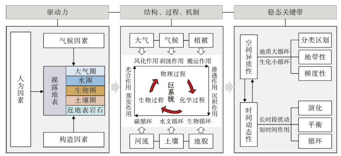
图1
当前地理学视域下的地球关键带研究体系和内容
Fig. 1
The framework and content of the Earth's Critical Zone from a geographical perspective
2.2 人地互动关系:地球关键带研究的趋势
地球关键带自提出之初就重视人类对于关键带进程的多种需求、压力和塑造作用。人类世以来,人类社会对于食物、物资和生活空间的需求不断“扰动”着地球关键带进程,近几个世纪的工业化、城镇化和全球化更使人类成为重塑地球表层面貌的巨大驱动体[17]。当前,学界虽已广泛承认人类活动对于地球关键带过程的驱动作用,但对于其中人地关系的理解仍然以人类中心主义下的生态系统服务论和生态中心价值观下的人类破坏论为先验知识。因此,急需进一步以人地互动的关系视角重新审视、明晰和扩充关键带空间载体、要素、主体、互动模式和演化机制的认识。
生态系统服务视角下的功能论主导着现有地球关键带研究中对于人地关系的诠释,从关键带的自然生态响应的基本功能出发,最终指向对人类社会经济发展的资源支撑与服务功能。生态系统服务视角是指人类通过从自然环境中直接获取商品和服务而受益,并使用经济价值的观念评估衡量这些利益[18]。这体现出以人类为中心的本体论立场对于自然环境的伦理准则与复杂价值观的设定[19]。从这一视角出发,地球关键带因控制着地球上的能量、水、碳、营养物质、大气成分和污染物的输送和循环,被认为对人类的生命、生计和发展具有供给、支持和调节作用,包括食物供给、水质净化与储存、土壤保持、生物多样性维持、气候调节等[13-14]。例如,已有研究以农业生态系统、城市生态系统、自然保护区等为例,探讨了地球关键带在服务人类社会经济过程中的资源供应、生命维持和环境调控功能[1,5,7]。同时,随着人类社会对于自然环境的诉求愈发多样,地球关键带的社会资源和文化服务价值也受到学者关注[20],相关研究中将地球关键带的景观和生态系统视为人类文化审美、地方依恋、身份认同与社会凝聚力以及环境教育价值的重要来源[21],为理解人类社会制度和文化规范对于关键带的主观塑造作用提供了重要启示。
地球关键带研究中对于人地互动关系的另一层表征是人类对于关键带的破坏性改造,强调人类在生计和发展需求下的改造利用实践导致人地系统失调,继而引发关键带的系统紊乱和演化的不可持续性。这一人类破坏论来源于生态中心主义对于人类中心主义人地观的批判。生态中心主义认为人类是更大生态系统的一部分,由于人类只重视自然环境的工具价值而忽视其内在价值,因此所采取的环境管理方式破坏了自然生态系统的福祉和完整性[22]。这一观念下,人类被认为是改变地球关键带平衡的重要媒介,在极短时间内通过多种方式参与并改变了关键带物质与能量交换的速率、通量、特征和演化过程[3,23]。特别是自20世纪中叶以来,在人口增长、耕地紧张、快速城市化以及基础设施建设等需求下,人类对土地的开发、改造和利用在短时间内极大改变地球表层土壤的功能与演变过程[11],不可逆地改变了人类与自然交互的模式以及地球表层的性质,致使环境恶化以及生态灾害风险发生[24-25]。这表明人类在生计和发展需求下的生产生活实践正在改写地球关键带物质圈层的空间形态和结构,同时地球关键带功能的改变也直接或间接地反作用于人类社会系统本身。
综上,当前地球关键带研究中已经关注到人地关系的多样表征,但仍受到人类中心主义和生态中心主义两种观念主导,强调人类和环境之间单向的、僵化的和被动的二元关系。事实上,人地关系作为人文地理学研究的核心,学者们已经形成了对于动态的、耦合的和复杂的人地互动关系的系列理论和框架。因此,未来研究需要审视二元的人地观下形成的对于人类和地球关键带的先验性认识[5],从人地互动的关系性视角重新认识地球关键带的空间内涵、理论模型与分析工具,并形成相应的地球关键带研究框架。
2.3 人地互动关键带:理论必要性和创新性
立足于当下全球化、现代化和城市化的现实背景,人地互动关键带将沿用地球关键带的“要素—通量”视角,并着眼于人类社会要素与地球关键带之间的相互作用关系。在当前地球科学视域下所开展的关键带研究中,学者们以水、碳等特定物质和能量要素作为研究通量,应用数学模型分析地球关键带演化的物理、化学和生物等驱动力作用过程[26]。而在人类世,特别是当前高度现代化的社会背景下,对于地球表层系统的重塑不仅仅是自然要素在自然规律下运行产生的结果,而更多受到人类在不同的经济、制度、文化和伦理等社会框架下对于多种社会要素的需求和再分配的影响。其中,人口、资源、资本、知识、信息和制度等要素在不同的区域、空间、层级、机构、群体和个体之间的流动已经构成了重塑地球表层形态和景观演变的主导性驱动力。可以认为,人地互动关键带中对于人类社会要素的引入,不仅有助于准确识别人类世背景下重塑地球关键带演化的直接驱动力,也将为理解人类和环境之间的复杂互动提供具象化的、具有操作性的数据分析要素。
当前对于地球关键带人地关系的研究多着眼于人类的技术和经济活动等对于环境的直接破坏性改造行为,而忽视了导致这些行为发生的文化、制度和价值观等复杂的社会系统运行规则。事实上,人类对于地球关键带的改造行为在一方面受到社会系统运行规则的制约。例如,在追求经济效益、寻求区域发展以及赢得国家或地方竞争等现代主义的社会话语下,人类对于环境的开发和改造行为显示出在区域、强度和方式上的多种差异。而另一方面,人类与环境之间的相互作用受到社会价值观的影响,源于人类与其他物种和生态系统的情感和认知互动,通过影响人类对于自身在自然环境中的定位,定义着人类对环境的改造行为是否“正确和适当”[27]。可见,人地互动关键带中对于“人”的理解将超越简单的“直接行动者”,而将“人”视为制度规则和环境伦理之间持续协商的复杂社会系统。这将有助于从人类社会的生产方式变化、社会文化结构以及个体决策的主观性等多维度社会过程中理解人类世下的地球关键带演变机制,也将为人类社会系统调节提供重要的认识基础。
人文地理学长期关注地球表层系统的人地关系,形成了诸如人地关系地域系统、人地圈等着眼人类和环境之间复杂互动反馈作用的概念体系、综合框架与成熟范式[28⇓⇓⇓-32],为建构人地互动关键带的概念提供了重要的参考。但当前相关实证研究多着眼于乡村、山地、流域,或历史时期聚落与城市等人类活动强度相对较低的人地系统[33],缺乏对于全球化、城市化和市场化进程中高强度人类活动区域中人地复杂互动的关注[34-35]。另一方面,当前科学主义观念下的数学模型中对于特定区域人地关系研究呈现精确化、片段化、孤立化态势,大多数学者聚焦于特定城市或区域中的某一人类活动要素对环境要素的影响或者环境要素与人类社会经济指标的支撑[36]。因此,人地互动关键带将从多要素在区域间流动的关系视角出发,借鉴人文地理学中对于人地关系的相关认识框架、衡量指数、空间尺度与等级评定等研究基础,为地球表面社会经济与自然环境高强度互动提供多要素、多过程、多尺度耦合的视角,并对当前地球关键带研究起到有效且必要的补充作用[37]。
3 人地互动关键带的理论基础、内涵与探索性理论框架
3.1 人地互动关键带的理论基础
3.1.1 人地互动关系理论模型
过去的一个多世纪中,环境决定论、人类生态学和自然灾害研究等由地理学家构建的人与环境相互作用的理论,都反映出人类与自然的二分法哲学观[38]。然而,经济全球化、快速工业化和城市化发展正在赋予人地关系新的时代内涵。随着人口增长、技术进步和区域发展,人类改变环境的方式、广度和深度或者对于环境变化的反馈变得更加密集和广泛[32,39]。这使得人文地理学者深刻认识到地表人地系统的组成要素间,以及要素与系统间存在着复杂的相互作用和反馈关系,并提出了促进区域可持续发展作为适应新时期人地关系研究的核心和目标[40]。同时,现代社会中日益增长的流动性使人类和环境之间的互动逐步超出了地理空间边界的限制,使全球环境变化胁迫、人地矛盾频发以及区域间激烈竞争成为所有的国家、区域和地方共同面对的重要议题。可见,在世界实现可持续发展目标和中国致力生态文明高质量发展的新要求下,厘清人地互动关系的核心内涵是形成和完善人地互动关键带概念体系的前提条件。
人地互动是一个跨学科、跨尺度以及城市化的议题。近年随着人地互动理论研究与实践探索的不断深入,将环境压力和社会变化直接联系起来的简单的、确定性的关系不足以解释当前人与环境之间的相互作用。学者们提出需要理解环境系统和人类社会系统运行中所涉及复杂的相互作用和各因素之间的非线性关系[37,41]。例如,面对区域人地不协调问题时,既需要分析人地相互作用的维度、动力学和恢复力,同时也需要考虑不同主体或要素之间的权衡、协同作用和反馈效应。因此,相较于经典的人地关系研究,人地互动理论体现出3个方面的特性:① 关注人类和环境之间复杂的相互作用与反馈形成的网络关系;② 重视所有空间尺度上人类行动与环境变化之间的直接作用和间接影响,使人类通过有效的环境管理在地方或者全球尺度上调节人地矛盾;③ 相较于乡村、国家公园和自然保护地等人地互动强度相对低的系统,这一概念面向的现实对象与目标是城市化世界的可持续未来[37]。
表1 人地互动关系的代表性理论模型
Tab. 1
| 类别 | 名称 | 人地互动内涵 | 关键要素 | 模型框架 | 文献 |
|---|---|---|---|---|---|
| 均衡性 模型 | 压力承载 模型 | 人类经济活动产生的压力和资源要素供给能力的匹配程度 | 资源要素支撑(人均资源量);生态环境约束(脆弱性等);人类活动的施压强度(国土开发);人地系统开放程度(可达性等)。 | 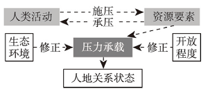 | [43] |
| “支点” 模型 | 特定历史时间节点上,人口数量在当时社会经济发展水平下达到饱和,人—地系统达到平衡 | 气候;环境灾害事件;生存资源;适应人类生存环境;人口数量;人类活动强度;环境改良行为;社会统治体制与政策;技术与社会革新;生产系统。 | 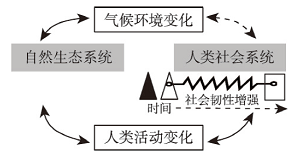 | [44] | |
| 适应性 循环 模型 | 社会—生 态系统适 应性模型 | 环境、经济和社会之间的相互关系系统能够可持续地提供人类所需的生态系统服务 | “风险”“刺激”“压力”等外部扰动(全球环境变化、自然灾害、生态恶化、社会冲突城市病等);人类社会系统对外部扰动的互馈、信息交流与决策机制(如政府调控措施、农户生计行为、策略等)。 |  | [47] |
| 社会—生 态适应性 治理模型 | 通过调节社会—生态系统的权利分配与行为决策机制持续地保障人类福祉 | 主体(具有不同行为模式和决策能力的个体或集体);结构(主体与环境间的相互关系);动态(系统内部过程或外部扰动)。 |  | [48] | |
| 系统 耦合 模型 | 人地系统 耦合模型 | 人类经济社会系统与自然生态系统交互作用、相互渗透形成适度耦合,系统会正向演替和协调发展 | 土地利用(人类社会经济活动强度与自然环境累积作用程度);人口流动与空间集聚(工业化等);环境排放(碳排放等);资源开发与能源开采(直接干扰);政策管理与环境治理(人类调适)。 |  | [32] |
(3)系统耦合模型:强调人类经济社会系统与自然生态系统交互作用、相互渗透的人地耦合机理[32]。该模型着眼于自然过程与人文过程的综合研究,认为社会经济系统是人类活动的主体和人地系统耦合并驱动环境变化的主因,提出了土地利用方式与强度、人口流动与空间集聚、环境排放、资源开发与能源开采、政策管理和环境治理的6个维度的社会经济过程的人地系统耦合机理。
这些代表性理论模型的提出综合了多学科研究中用以处理复杂系统的最适应思想、逻辑与方法,对人地互动关系的理论分析模型建构、定量诠释与思想方法形成均具有重大贡献,极大地丰富了人地关系相关研究,也为人地互动关键带的概念诠释提供了理论依据。对于人地互动关系内涵的认识从平衡状态、动态适应过程和复杂系统耦合的方面突出了人地相互作用、相互影响的对立统一关系,强化了新时期面向人类世、立足人地圈的地表系统演化中人类活动的主导作用。
3.1.2 发展地理学与空间均衡理论综合
发展地理学与区域发展空间均衡的理论视角能够为人地互动关键带的演化过程提供内部驱动力的解释[49-50]。其中,发展地理学侧重解析发展与社会、经济、政治等关键要素的联系,寻求发达区域与不发达区域之间的差异。这有助于为人地互动关键带内部区域发展格局与过程的社会机制分析提供关键思路。在此基础上引入区域空间均衡的思想,即实现区域发展空间均衡的前提是资源要素在区域间的合理流动[51]。区域之间发展水平差距形成的势能差,则是导致发展要素在区域间流动,并由此引发区域发展格局变动,最终趋向稳定态—均衡的区域发展格局的核心作用力[41,52]。由于人口和资源等发展要素在区域间的流动方向、强度和过程可被精确量化,因此这一要素流动视角的引入将能够为人地互动关键带内部的空间演化过程的作用关系机理提供定量模型分析的可能。
当前,上述理论视角在新时期人地可持续发展的背景下,将“发展”的内涵从经济增长为主延伸成为“经济—生态—社会”相协调的综合效应,这与人地互动关键带的过程和目标不谋而合。在全球环境变化、国际劳动分工以及区域发展转型的背景下,人地互动关键带内部存在着发展失衡、人地不协调等影响人类社会福祉的巨大问题。因此,当前发展地理学的研究不断转向知识促进区域转型发展、缓解资源环境压力和实现可持续发展目标等内容[39]。同时,人地系统可持续发展思想中也将实现空间均衡的各种效益分解为经济效益、生态效益和社会效益,强调实现区域发展格局稳定状态的必要条件是三大效益之和在区域之间的均衡[41]。其中对于生产、分配、消费以及生活方式等人文经济过程的引入则为人地互动关键带内部空间演化的人文要素流动及其社会机制分析提供了思想基础。
3.1.3 社会—空间理论集合
人地互动关系模型可以测算人口、土地和资源等要素对于关键带的影响力水平,而社会—空间理论将为人地互动关键带的演化过程提供基于现实的、深刻的人类社会系统运行规律的解释框架。该理论体系是由列斐伏尔、哈维和索亚等学者在马克思主义空间思想基础上逐渐延续、演化发展形成,本质上是社会和空间之间关系的辩证法[53-54]。其思想精髓在于,空间不仅是社会的产物,还反映和反作用于社会[55]。宏观层面上,该理论被广泛用于分析中国现代化进程中的区域基础设施配置、区域竞争、城市新区建设和城市更新以及产业空间布局等[56-57],用以阐释制度和资本等权力结构对地理景观和空间进行管理、规划和创造的过程[58-59]。在该视角下,人地互动关键带中的区域发展格局可以被认为是其所处的社会经济关系的空间体现。进而,可通过制度设计对空间要素资源进行重新配置,实现区域协同与设施公平。
在微观视角下,社会—空间理论思想能够使“人”在影响和塑造关键带过程中的主体性得以体现。人地互动关键带中的“人”不仅指社会权力运作系统,也包括非完全理性个体的“人”所发生的社会经济日常行为、轨迹、模式、交往以及形成的共同体[60]。“人”主要通过行动者、社会网络以及日常生活实践实现对于空间的创造性生产,以回应政策制定者和技术专家对于空间资源进行定义、分配和利用导致的不平等以及空间的同质化[45]。这一微观视角的引入将更有利于自下而上地分析人地互动关键带中的重要枢纽、节点或者其他小尺度地域系统形成过程中的要素流动或权力结构,通过关注特定行动者的日常生活或者基于社会网络的地方政治等社会行为,探讨空间资源、设施、景观等在相对小尺度范围内的配置过程。
3.2 人地互动关键带的研究对象、任务和技术路径
人地互动是在全球化、现代化和城市化背景下所提出的与时俱进的人地关系理念。人地互动关键带的物质空间形态、要素流动过程、相互作用网络以及社会调节机制等都来源于对人文地理学“人地互动”以及地球科学“地球关键带”两大概念体系的融合与继承。人地互动关键带的实体对象是人类和环境在多个时空尺度上的高强度交互界面。受到自然环境制约、人口聚集、开发方式与强度、资源要素的流动、生态服务价值观和环境管理差异等影响,人地互动关键带在地球表层呈现出非均质和不连续的空间特征。在此基础上,人类社会和自然环境系统中所有不同维度的要素、运行规则和变化过程均统一于这一物质空间(图2)。即人地互动关键带不仅是一个探讨人地如何相互作用的容器,更重要的是为其中人类和环境之间的复杂关系提供一种综合自然规律和社会规则的认识论。基于该认识,地理学家对于人地互动关键带的研究任务是:以要素流为视角,分析多尺度人地互动区域的时空演化过程、模式与规律,并在自然环境变化和社会运行的过程耦合框架下揭示其中的主体互动机制与系统效应,最终指向人地和谐、区域协同现实价值的综合地理研究。
图2
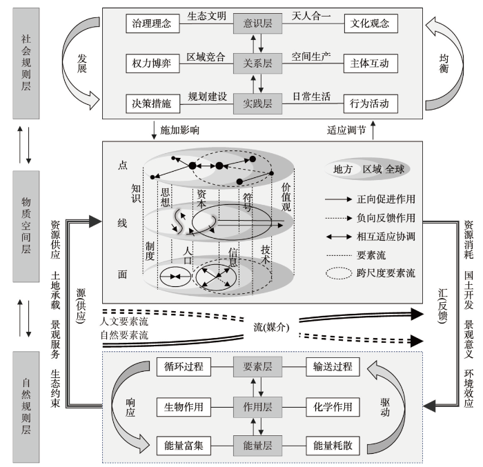
图2
人地互动关键带的理论框架探索
Fig. 2
Exploratory theoretical framework for the critical zone of human-earth interaction
3.3 人地互动关键带的理论框架探索
“源”和“汇”构成了理论框架中理解人类和环境相互作用的基本因果链。“源”主要指自然环境为人类活动所需提供资源、土地、景观和生态容量的能力,即当自然环境能够满足人类可持续发展的各项需求时,自然系统就是社会系统的“源”。“汇”主要指人类活动对于资源的消耗、土地的开发和由此引发的环境效应对自然系统造成的压力,往往需要特定的社会调节系统介入才能缓解此类压力。“流”是自然系统和社会系统之间的联系工具和平衡媒介,不仅包括传统意义上的自然和人文要素(如人口、资源、土地),也包括一切能够跨越空间、尺度和边界产生效应的其他要素(如知识、制度、思想、资本、信息、符号和价值观)等。其中所体现出的系统开放性和要素流能够在一定程度上打破静止地理空间的约束和管制,跳出以往研究中将绝对人口数量作为人类系统对环境压力的认识[66-67]。因此,“要素流”作为分析框架中重要的分析参数,对于其类型、方向、强度等量化指标分析,可以对人地互嵌过程和耦合效应等提供重要的认识依据。
人地互动关键带理论框架的核心在于从多个维度对“流”的丰富内涵进行分解[68-69]。首先,“流”是在区域发展势能差驱动下产生的动态过程,表现为要素的时间变化和空间流动对于关键带内区域发展格局的塑造。例如人口、资本在不同等级城市间的流动既受到发展势能差的驱动,同时也塑造着新的区域发展格局。其次,“流”是一种调节机制,通过对要素流的类型、方向和强度的社会调节可以实现区域之间的动态均衡。例如,政府对于资源和资金的转移调配能够满足不同区域的差异化发展需求,实现区域协同发展。最后,“流”是一种关联响应,不同要素的地方化嵌入过程会引发其他要素的响应,使人地系统处于稳定的循环适应过程。例如,生态文明的价值观念和制度要素的地方化实践能够引发资源、能源、产业等其他要素的联动效应,使系统处于平衡状态。可见,通过对于“流”的意义分解,以及促进要素流动的社会机制的联动,能够将人类社会的复杂运作逻辑与实践引入地球关键带科学,有助于在人类世背景下,全面、系统及客观地认识关键带科学,并有效应对当前的全球资源、环境和社会危机。
人地互动关键带的空间实体是人类社会与自然环境互动程度最剧烈的地表层,其空间尺度由人地互动的方式、强度和效应等决定[13]。理论上,人地互动关键带的要素“流”发生在跨越地方、区域和国家边界的全球尺度,但“源”“汇”过程则是区域性人类活动的结果。这使得人地互动关键带“人”“地”“要素”之间存在空间不匹配,挑战着地理学者对于区域人地关系理解。而现实上,过去半个多世纪的全球化使跨越各类边界的地域开放性重塑了全球范围内各个空间尺度上的人文经济地理格局。全球、国家、地方、城乡之间的交流强度越来越大,人流、物流、信息流、资金流甚至制度流等人文要素流构成的流空间已经超越静止地域中的资源供应与环境响应,有望成为解释人地互动关键带的格局演化与尺度效应的关键过程[29]。此外,数据技术上,基于遥感数据获取、网络社交大数据获取和地理信息分析能力的增强,分析人地互动关键带在不同空间尺度上的动态过程和现实结构成为可能。这不仅可以在宏观尺度上解析关键带在全球尺度的系统性网络结构,也可以从微观尺度上解释人类社会行为和社交过程的时空积累对于关键带形态和结构的塑造[29]。可见,人地互动关键带的空间实体是许多复杂的、相互关联的“源”“流”“汇”过程在广泛的空间和时间尺度上耦合作用的结果,在具体的研究中需要根据不同的要素属性与特征,对其流动和作用过程的空间尺度进行有效识别[70-71]。因此,在应用人地互动关键带框架进行区域分析时,需要采取不同的观测尺度、过程尺度和操作尺度,在斑块化的、异质的、不连续的地球表层系统中认识人地互动关系。
“点”“线”和“面”是人文地理学者从尺度的内涵出发刻画地球表面空间特征的重要维度。其中,点主要标示位置性和独特性;线主要从连接性、中心性和流量等地理特性出发关注网络拓扑结构中的要素流动;面主要指一种围合的空间,涉及面积大小、控制范围和权力层级等地理属性[72]。基于这种认识,“点”“线”和“面”被认为是从人文地理空间形态出发,分析区域发展格局、要素扩散过程以及国土空间开发时序等地理过程的抽象模式[12,34],可以很好地认识人地互动关键带内尺度不等、层级不同、形态各异的相互依赖、相互耦合的地理区域,能够有效弥合地方、区域和全球等跨越不同空间尺度的人地互动关键带研究。其中,“点”是一个具有控制、辐射和主导功能集合的节点,主要用于分析区域中心城市、各级居民点、中央商务区、产业集聚区等人地相互作用程度最高的关键节点。“线”是对于物质、能量、人口和信息等自然和人文要素在地方、区域内(间)和全球空间流动的路径表达,主要用于分析能够促进或阻隔要素交换的边界区域、交错地带以及多种形式的廊道等,往往是解决特定人地矛盾的突破口。“面”是由“点”和“线”相互作用而成的,综合了“生产、生活和生态”的多维度空间组织概念[73],主要用于分析人地互动关键带在人文—自然要素作用下形成的空间结构、要素比例和格局演化(中心化、分化、极化等),其现实价值在于从要素合理流动、产业分工协作以及设施配置等空间治理视角下为促进区域空间均衡发展提供认识依据。
4 人地互动关键带的应用价值
新时期中国生态文明建设、新型城镇化与乡村振兴战略持续推进是中国式现代化的重要支撑。人地系统与国土空间治理格局正在经历着历史性变革,人地系统协调与区域发展面临的地理问题愈加复杂,促使地理学进入系统研究时代[24,74]。以上既是人地互动关键带的理论背景,也对人地互动关键带的实践应用提出了新的学科使命。即在总体上促进人口经济发展与资源环境相协调,在空间上促进区域间均衡协调的发展格局,在时间上形成可持续的资源与国土开发利用时序,并最终建构社会治理体系与自然环境变化之间的动态均衡。人地互动关键带的内涵与理论框架将服务于国家战略需求,并且至少在以下几个重要应用场景中,为实现可持续、高质量发展提供决策支持:
(2)区域资源配置与公平性:推动基本公共服务均等化是实现社会公平的关键所在[77]。当前在大都市圈、特大城市和区域性中心城市的“虹吸效应”“马太效应”影响下,边缘区域的发展要素、资源和设施投入有可能被持续削弱。厘清社会干预协调机制与主体,有助于从资源分配、监管、优化资源配置结构、区域间合作等方面促进区域均衡协调发展。
(4)生态系统保护、开发与恢复:环境污染和退化是全球性问题,但环境效应及其地方响应却具有显著的区域差异。在国土空间规划的框架下,通过对于自然保护区、国家公园以及城市绿地等生态空间规划,强化区域中自然演化系统作为“源”的供应作用;同时,通过节能减排、植树造林、河湖休养生息,耕、林、草间的科学协调等社会调节实现生态系统修复。
5 结论与讨论
人地互动关键带的概念既有重要的科学意义,又具备显著的现实意义,其理论体系与框架响应了科学研究前沿也具备显著的应用潜力。人地互动关键带的提出受到地球科学中对于“地球关键带”相关概念模型与实证应用的启发:“地球关键带”所具有的界面交互、空间异质、过程复合与动态演化的特性具有天然的地理学特征。其中,对于要素的流动和交换、时空尺度的包容以及多过程耦合的系统认识与实证研究,与人文地理学中对于地球表层人地系统的认识论不谋而合,显示出两大概念体系之间存在协同融合的理论基础。事实上,也正是因为人文地理学者们多年来对于人地关系地域系统、区域均衡发展等地理知识体系的持续耕耘,才使人地互动关键带概念得以形成和建构,并有望成为地理学中有前景、有活力、能促进分支学科对话的概念框架和分析工具。
在认识论和方法论上,人地互动关键带能够有效整合跨学科的地理实践、知识生产和数据使用模式,并应用不同领域的哲学认识差异,为理解地球表层复杂过程和模式提供系统视角。① 人地互动关键带既是一种空间载体(地表系统),也是一种空间实践模式(人地互动关系的表征)。有效应用经验数据(观测数据和社会调研)、数学描述(调查数据)以及技术数据(遥感大数据等),方能理解人地互动关键带的多维度、多尺度和多要素特征;② 人地系统的复杂性和时空关系决定了任何单一的数学模型或者社会理论都无法独立诠释人类世下的关键带演化过程。“源—流—汇”为理解人地互动关键带的过程性提供了3个阶段的认识路径,“点、线、面”则为不连续的人地互动关键带的空间异质性提供了分析工具,以便更有效地解决现实世界的问题;③ 人地互动关键带强调对“自然科学”“社会科学”的角色和责任的整合性思考,是一个兼具批判性和应用价值的概念。这一概念将在理论上有效整合地球表层自然和人文的时空过程,将人类社会的复杂运作逻辑与实践引入地球关键带科学,能够为自然、人文和信息地理学家提供了基于学科认同、面对现实问题开展合作协同发展的机会。
地理学对人地关系演变的复杂历史和现实有着深刻的理解,是塑造人类世学术未来的理想科学。人地互动关键带的概念体系并非是对地球表层系统人地关系研究的完全创新,也不能涵盖人类与环境之间相互作用的所有复杂性。为了在深入阐释人地互动的同时简化复杂性,对其应用应侧重于解决确定地理区域内的具体问题。面对全球自然环境变化和地缘经济政治挑战,以及生态文明建设背景下对于国土空间发展战略的新要求,区域间、城乡间发展不平衡、不充分的矛盾日益加剧,贫困、发展方式转型、国际贸易竞争、气候变化、环境退化等方面的危机与挑战严重制约着区域可持续发展能力,亟需在新的认识框架下利用地理学科知识指导促进产业转型发展、缓解资源环境压力、优化国土空间发展格局,以实现可持续发展目标[9]。
诚然,本文对于人地互动关键带中的理念梳理、内涵界定和框架建构是探索性和争鸣式的,对于具体实证研究应用中的分类架构、指标体系和数据模型等操作性尚未作深入探讨。期待未来研究立足全球自然环境变化和经济政治不稳定性的挑战,以及中国生态文明建设背景下对于国土空间发展战略的新要求;通过理论和实证研究的积累,进一步完善人地互动关键带的认识论与方法论;并据此建立可持续的社会支持系统,共同助力国家科学制定空间、环境与社会发展战略,促进国土空间高质量发展并有效促进自然系统与社会系统的深度、高效协同。
参考文献
Crossing disciplines and scales to understand the critical zone
DOI:10.2113/gselements.3.5.307 URL [本文引用: 3]
Critical zone science in the Anthropocene: Opportunities for biogeographic and ecological theory and praxis to drive earth science integration
DOI:10.1177/0309133319864268
URL
[本文引用: 2]

Critical Zone Science (CZS) represents a powerful confluence of research agendas, tools, and techniques for examining the complex interactions between biotic and abiotic factors located at the interface of the Earth’s surface and shallow subsurface. Earth’s Critical Zone houses and sustains terrestrial life, and its interacting subsystems drive macroecological patterns and processes at a variety of spatial scales. Despite the analytical power of CZS to understand and characterize complicated rate-dependent processes, CZS has done less to capture the effects of disturbance and anthropogenic influences on Critical Zone processes, although some Critical Zone Observatories focus on disturbance and regeneration. Methodological approaches from biogeography and ecology show promise for providing Critical Zone researchers with tools for incorporating the effects of ecological and anthropogenic disturbance into fine-grained studies of important Earth processes. Similarly, mechanistic insights from CZS can inform biogeographical and ecological interpretations of pattern and process that operate over extensive spatial and temporal scales. In this paper, we illustrate the potential for productive nexus opportunities between CZS, biogeography, and ecology through use of an integrated model of energy and mass flow through various subsystems of the Earth’s Critical Zone. As human-induced effects on biotic and abiotic components of global ecosystems accelerate in the Anthropocene, we argue that the long temporal and broad spatial scales traditionally studied in biogeography can be constructively combined with the quantifiable processes of energy and mass transfer through the Critical Zone to answer pressing questions about future trajectories of land cover change, post-disturbance recovery, climate change impacts, and urban hydrology and ecology.
A classification scheme for earth's critical zones and its application in China
DOI:10.1360/SSTe-2020-0249 URL [本文引用: 2]
地球关键带分类方法与中国案例研究
Earth's critical zone and hydropedology: Concepts, characteristics, and advances
DOI:10.5194/hess-14-25-2010
URL
[本文引用: 9]
. The Critical Zone (CZ) is a holistic framework for integrated studies of water with soil, rock, air, and biotic resources in the near-surface terrestrial environment. This most heterogeneous and complex region of the Earth ranges from the vegetation top to the aquifer bottom, with a highly variable thickness globally and a yet-to-be clearly defined lower boundary of active water cycle. Interfaces among different compartments in the CZ are critical, which provide fertile ground for interdisciplinary research. The reconciliation of coupled geological and biological cycles (vastly different in space and time scales) is essential to understanding the complexity and evolution of the CZ. Irreversible evolution, coupled cycling, interactive layers, and hierarchical heterogeneity are the characteristics of the CZ, suggesting that forcing, coupling, interfacing, and scaling are grand challenges for advancing CZ science. Hydropedology – the science of the behaviour and distribution of soil-water interactions in contact with mineral and biological materials in the CZ – is an important contributor to CZ study. The pedosphere is the foundation of the CZ, which represents a geomembrance across which water and solutes, as well as energy, gases, solids, and organisms are actively exchanged with the atmosphere, biosphere, hydrosphere, and lithosphere, thereby creating a life-sustaining environment. Hydropedology emphasizes in situ soils in the landscape setting, where distinct pedogenic features and soil-landscape relationships are essential to understanding interactive pedologic and hydrologic processes. Both CZ science and hydropedology embrace an evolutionary and holistic worldview, which offers stimulating opportunities through steps such as integrated systems approach, evolutionary mapping-monitoring-modeling framework, and fostering a global alliance. Our capability to predict the behaviour and evolution of the CZ in response to changing environment can be significantly improved if cross-site scientific comparisons, evolutionary treatment of organized complex systems, and deeper insights into the CZ can be made.\n
A framework for the regional critical zone classification: The case of the Chinese Loess Plateau
DOI:10.1093/nsr/nwy147 URL [本文引用: 4]
Frontier approach of the sustainable process and pattern of human-environment system
DOI:10.11821/dlxb201408003
[本文引用: 1]
In combination with the author's review of frontier issues in human geography in recent years, this paper clarifies that uncovering the spatiotemporal difference rules of human-environment system interaction in the geographic pattern is the highest-level scientific puzzle in modern geography, and is the understanding of key issues which could decide the prospect of future geography. Four practical methods including "process induction, regional comparison, qualitative analysis, logical judgment" until now for integrated human-environment system researches are proposed. Aiming at four frontier fields including regional equilibrium, resources and environment carrying capacity, territorial function, and spatial structure, academic ideas including the driving forces of regional development pattern changes, the impact carrier of natural sphere on human activity sphere, the rules and methods for integrated geographic zoning, and the changing laws of "living-production-ecology" spatial structure, are discussed. Finally, this paper discusses the significance and key issues of regional sustainable development in the framework of "Future Earth", and presents that the integrated method system and basic theoretical system of comprehensive research in complexity science based on "integration of both natural and social sciences" and "interpenetration of both basic researches and decision-making application", will profoundly influence research progress of the process and framework of human-environment system.
人地系统可持续过程、格局的前沿探索
DOI:10.11821/dlxb201408003
[本文引用: 1]
本文结合笔者近年来在人文地理学前沿问题探讨的综述,阐释了人—地系统相互作用时空分异规律是现代地理学最高层级的科学难题、也是决定未来地理学前途的关键问题的认识,提出了截至目前开展人地系统综合研究所采用的“过程归纳、区域比较、定性分析、逻辑判断”等4个实用方法,并围绕着区域均衡、资源环境承载能力、地域功能、空间结构等4个前沿领域,讨论了影响区域发展格局变化的驱动力、自然圈对人类活动圈层的作用、综合地理区划原理和方法、以及“生活—生产—生态”空间结构变化规律等研究的学术思想,探讨了“未来地球”框架下区域可持续发展研究的意义和重要命题,认为“自然科学和社会科学交叉”、“基础研究和决策应用贯通”的复杂性科学基础理论体系和综合研究集成方法体系建设,将深刻影响着人地系统过程和格局的研究进展。
The Anthropocene is functionally and stratigraphically distinct from the Holocene
Monitoring earth's critical zone
DOI:10.1126/science.1179117 PMID:19965414 [本文引用: 1]
Global human-made mass exceeds all living biomass
DOI:10.1038/s41586-020-3010-5 [本文引用: 2]
Soil security: From Earth's critical zone to ecosystem services
DOI:10.11821/dlxb201512001
[本文引用: 2]
Soil is an important natural resource that humans rely on and civilization is based upon. As the critical component of the Earth's critical zone, pedosphere is most active in Earth's surface system. Moreover, soil processes are considered as the control point for the flows and transformations of material, energy and information. In wake of the increasing attention to soil's multi-functions, traditional soil concept on its functions and roles is being challenged. Therefore, the concept of soil security is proposed, which is a strategic framework with the aim of soil sustainable development, and it can provide guidelines for the sustainable utilization and conservation of soil resources. In this review, the connotations of Earth's critical zone and soil security, and the difference and close relationship between each other are discussed. The ecosystem services in the framework of soil security are summarized. Finally, perspectives on future soil security research needs in the context of ecosystem services are proposed.
土壤安全: 从地球关键带到生态系统服务
DOI:10.11821/dlxb201512001
[本文引用: 2]
土壤是人类赖以生存和文明建设的重要基础资源。作为地球关键带的核心要素,土壤圈是地球表层系统最为活跃的圈层,而且土壤过程是控制地球关键带中物质、能量和信息流动与转化的重要节点。由于土壤的多重功能不断得到重视,传统的土壤概念已经无法全面反应土壤的功能和作用,为此本文提出了土壤安全的概念。土壤安全是一种基于土壤可持续发展目标而提出一种系统战略框架,为土壤资源的可持续利用和保护提供了理论基础。本文重点论述了地球关键带和土壤安全的内涵以及两者之间的差异和紧密关系。此外,还对土壤安全框架下的生态系统服务进行了梳理和总结,最后对面向生态系统服务的土壤安全需求进行了展望。
The scientific logic and research trends of human critical area
DOI:10.13249/j.cnki.sgs.2022.01.003
[本文引用: 4]
Human activities have become a forceful geological agent on the Planet by rapidly and dramatically altering the natural world, which, in turn, is affecting the well-being of humans themselves. The cumulative impact of human activities on the Planet has driven an ever-evolving human-land relationship and left recognizable marks on the Planet’s surface, i.e., the human critical area (HCA), which is an area that characterizes the surface landscape created by human beings in the Anthropocene. It is a relatively homogeneous area of human activities within the geosphere and the basic unit of the human-land coupling system. Human’s perception of the human-land relationship over its nearly 10 000 years of history can be divided into 3 layers: human civilization and the earth’s environment; human activity and the geographical environment; and spatial behavior and land use. As the imprint mainly dominated by human activities on the earth’s surface, the HCA has a temporal-spatial attribute, showing in global, national, regional, local, and community scales. Each scale is with its types, structures, and expression forms. Specifically, the HCA on the global scale can be classified into the built-up area, agricultural area, ecological area, and bare area; the HCA on the national scale can be divided into the elemental area, functional area, and administrative area; the HCA on the regional scale can be classified into the ecological area, economic area, poverty area, and urban area; the HCA on the local scale can be divided into the small city, town, and village; the community-scale HCA can be classified into the block, residential building, and other geographical units. Further discussion on the HCA should focus on the followings: 1) identification, demarcating an objective spatial area that reflects the results of interactions of human-land through the analysis of factors (e.g., land use, transportation network, population density, economic level, night light, etc.) or the applications of deep learning and big data with the development of geospatial technology; 2) material cycle and energy flow, exploring the material circulation and energy flow in different types and scales in this key interface; 3) coupling mechanism and dynamics, exploring the rules and principles of element coupling, interface coupling, space-time coupling, scale coupling, system coupling, etc., as well as understanding the processes and manifestations of diverse dynamics over the evolved period of human to achieve coordination among subsystems; 4) geo-simulator and regulatory decision making, comprehensively simulating, analyzing, predicting, and optimizing the human key area with virtual simulation experiments. The HCA can provide an innovative theoretical and practical path for global sustainable development in the geoscience of China.
人类关键区的科学逻辑与研究趋势
DOI:10.13249/j.cnki.sgs.2022.01.003
[本文引用: 4]
人类关键区是人类社会进入人类世时代,人类所创造的地表景观在地理圈层中的特征区域。人类近万年历史对人地关系的认知可分为人类文明与地球环境、人类活动与地理环境、空间行为与土地利用3个层级。人类关键区具有全球尺度、国家尺度、区域尺度、地方尺度以及社区尺度。全球尺度的人类关键区可划分为建成区、农业区、生态区、裸露区。人类关键区未来的研究主要包括人类关键区的识别,人类关键区物质循环与能量流动,人类关键区耦合机理与动力机制,人类关键区地理模拟(器)与调控决策。人类关键区的提出为全球可持续发展提供中国地理科学的创新理论与实践路径。
Soil biogeochemical processes within the critical zone
DOI:10.2113/gselements.3.5.321 URL [本文引用: 2]
Inside the critical zone
DOI:10.1080/2373566X.2020.1803758 URL [本文引用: 1]
Coupling between biota and earth materials in the critical zone
DOI:10.2113/gselements.3.5.327 URL [本文引用: 1]
Geology of mankind
//Crutzen P J, Günter Brauch H. A Pioneer on Atmospheric Chemistry and Climate Change in the Anthropocene
Ecosystem services and beyond: Using multiple metaphors to understand human-environment relationships
DOI:10.1525/bio.2013.63.7.7 URL [本文引用: 1]
The influence of place attachment, and moral and normative concerns on the conservation of native vegetation: A test of two behavioural models
DOI:10.1016/j.jenvp.2011.08.006 URL [本文引用: 1]
What is the Earth's Critical Zone
什么是地球关键带?
Research on the evaluation method of the ecosystem services of Earth's Critical Zone
地球关键带生态系统服务评价方法研究
Limits to anthropocentrism: Toward an ecocentric organization paradigm?
DOI:10.2307/258965 URL [本文引用: 1]
Utilization & protection of water resources during urbanization
城市化过程中水资源利用保护问题探索: 以长江下游若干城市为例
Modern agricultural geographical engineering and agricultural high-quality development: Case study of loess hilly and gully region
DOI:10.11821/dlxb202010001
[本文引用: 1]
Agricultural geography is the interdisciplinary subject of agricultural science and geographical science, and agricultural geographical engineering is the further deepening and systematic application of the interdisciplinary research of geography and engineering in the field of modern agriculture and rural revitalization, and it is an important material basis to ensure the agricultural high-quality development. With the innovative development of modern agricultural science and technology and human-earth system science, the scientific and technological needs of regional agricultural infrastructure are increasingly strong, and agricultural geographical engineering experiments have become an important task of agricultural engineering technology research and farmland system management. This article expounds the scientific connotation, experimental principles and technical methods of agricultural geographical engineering, and takes the loess hilly and gully region as an example to carry out the experimental research on geographical engineering and discussed the countermeasures for high-quality agricultural development. Results show that: (1) Agricultural geographical engineering experiments mainly include soil and water allocation, soil layer composition, field experiment, ecological protection, geospatial analysis and monitoring for specific regional geographical environment and agricultural development issues, aiming to explore coupling law of resource elements for regional high-standard farmland construction and healthy agricultural ecosystem construction, and establish a sustainable land use system and multifunctional agricultural management model. (2) Agro-ecosystem experiments mainly includes trench slope protection methods, healthy farmland system structure, crop-soil matching relationship, economic analysis of farmland input and output, which aimed to reveals the coupling mechanism and optimal control approach of "crop-soil relationship" by carrying out interactive experiments and field trials for land improvement and crop optimization. (3) Optimization and regulation of crop-soil relationship is the main content of engineering experiment design, which includes six stages: climate-crop optimization, soil-body structure improvement, terrain-crop optimization, soil quality improvement, soil-crop optimization and benefit-crop optimization. (4) The core tasks of the application of agricultural geoengineering technology are to deepen the comprehensive research, reveal the micro-coupling mechanism and establish the engineering test paradigm, and its application path is mainly reflected in three dimensions of time, space, and logic. The geographical engineering experiment of modern agriculture and its application in the new era are conducive to enriching the frontier theories and methodology of agricultural geography, and are of great significance to the advancement of geographical engineering research and the decision-making of agricultural and rural high-quality development.
现代农业地理工程与农业高质量发展: 以黄土丘陵沟壑区为例
DOI:10.11821/dlxb202010001
[本文引用: 1]
农业地理学是农业科学与地理科学的交叉学科,农业地理工程是地理学与工程学交叉研究在现代农业与乡村领域的进一步深化和系统应用。随着现代农业科学技术和人地系统科学的创新发展,区域农业基础建设的科技需求日益旺盛,农业地理工程试验成为农业工程技术研发和农田系统管理的重要任务。本文阐述了农业地理工程的科学内涵、试验原理与技术方法,并以黄土丘陵沟壑区为例开展了地理工程试验研究和农业高质量发展对策探讨。结果表明:① 农业地理工程试验主要包括针对特定区域地理环境和农业发展问题的水土配置、土层复配、大田试验、生态防护、地理空间分析与监测,旨在探明区域高标准农田建设、健康农业生态系统营造的水土气生资源要素耦合规律,建立可持续土地利用系统与多功能农业经营模式。② 农业生态系统试验主要包括沟道边坡防护方式、健康农田系统结构、作物与土壤匹配关系、耕地投入产出经济分析,通过开展土地改良、作物优选交互试验和田间试种,揭示新造地“作土关系”耦合机理与优化调控途径。③ 作土关系优化调控是工程试验设计的主要内容,包括气候—作物优选、土体结构改良、地形—作物优选、土壤质量改良、土壤—作物优选、效益—作物优选6个阶段。④ 农业地理工程技术应用的核心任务是深化贯通综合研究、揭示微观耦合机理、建立工程试验范式,其应用路径主要体现在时间维、空间维与逻辑维三个维度。新时期农业地理工程试验与示范应用,有利于丰富农业地理学前沿理论与方法论,对于推进地理工程化研究和服务农业农村高质量发展决策具有重要意义。
Resource analysis, resource management and the integration of physical and human geography
DOI:10.1177/030913338300700107 URL [本文引用: 1]
Getting right with nature: Anthropocentrism, ecocentrism, and theocentrism
On the research core of geography: Territorial system of human-environment interaction
DOI:10.2307/140646 URL [本文引用: 1]
论地理学的研究核心: 人地关系地域系统
"Territorial System of Human-environment Interaction": A theoretical cornerstone for comprehensive research on formation and evolution of the geographical pattern
DOI:10.11821/dlxb201804001
[本文引用: 3]
Compared with the increasingly obvious humanistic tendency in foreign human geography, China's human and economic geography still follows Academician Wu Chuanjun's theory, with human and economic geography as an interdisciplinary subject which is the study of the formation and evolution of the distribution pattern of human activities under the interaction of natural circle and human circle. And China's mainstream school on human and economic geography has been formed with studies on spatio-temporal rule of sustainable development on territories with different space scales, territories with important production and living, and territories with typical geospatial patterns as the main research points. "Territorial System of Human-environment Interaction", developed by Academician Wu Chuanjun, is the important theoretical foundation not only for human and economic geography, but also for the comprehensive research on geography. The essence of the theory, which includes territorial functional, system structured, orderly process for spatio-temporal variation, and the difference and controllability of human-environment interaction system effect, is entirely harmonious with the forefront of thought of the "Future Earth" studies program. In recent decade, with scientific mode of urbanization, major function oriented zoning, road map for the Belt and Road Initiative, Beijing-Tianjin-Hebei urban agglomeration, rural hollowing and targeted poverty alleviation, revitalization of Northeast China and transformation of resource-based cities, and administrative area optimization as the main research objects, theoretical methods have been developed in the aspects of important sustainable process of human and economic geography, territorial function formation and ordering rules for comprehensive geographical pattern, formation and evolution mechanism of urban agglomeration and its resources and environmental effects, sustainable life cycle and the revitalization of the path for problem areas, the interaction between geopolitics, geo-economy and regions, and effect of cultural boundaries on sustainable development. China's human and economic geography has made great progress in discipline development, and the application results have produced profound influences on the ecological civilization construction and sustainable development in recent years. With decades of hard work, China's human and economic geography has reached a world-class advanced level, so as to console the soul and spirit of Wu Chuanjun on the occasion of commemoration of the centenary of his birth.
“人地关系地域系统”是综合研究地理格局形成与演变规律的理论基石
DOI:10.11821/dlxb201804001
[本文引用: 3]
同近年国外人文地理学呈现人文化趋势相比,中国人文与经济地理学秉承吴传钧先生关于人文与经济地理学是研究自然圈与人文圈相互作用下、人类活动分布格局形成和演变规律的一门交叉学科的定位,形成了以不同空间尺度的地域、重要的生产生活领域、以及典型的地域空间类型的可持续发展时空规律作为研究指向的中国人文与经济地理学主流学派。吴先生提出的“人地关系地域系统”理论不仅为人文与经济地理学,而且是为整个地理学的综合研究提供了重要的理论基石。地域功能性、系统结构化、时空变异有序过程、以及人地系统效应的差异性及可调控性,是该理论的精髓,这与“未来地球”研究计划的前沿思想完全契合。近10年来,以城镇化科学模式、主体功能区划、一带一路路线图、京津冀城市群、农村空心化和精准扶贫、东北振兴与资源型城市转型、行政区划优化等为研究对象,发展了人文与经济地理重要的可持续过程、地域功能形成和综合地理格局有序化规律、城市群形成演化机理及其资源环境效应、问题地区可持续生命周期与振兴路径、地缘政治地缘经济和区域间相互作用关系、人文界线对可持续发展的影响等理论方法。人文与经济地理学科建设取得重要进展,应用成果对近年来中国生态文明建设和可持续发展产生了重要影响。中国人文与经济地理学在全球范围内发展态势最佳、总体水平领先,以此告慰吴传钧先生,并以此纪念吴传钧先生百年诞辰。
Recent progress of studies on man-land relationship and its prospects in China
中国人地关系研究的新进展与展望
The evolution process and its mechanism of man-land relationship in China
DOI:10.11821/dlyj201808003
[本文引用: 1]
The evolution of man-land relationship is inheritable. Understanding the evolution process of man-land relationship and its mechanism from the historical perspective can help us to increase the comprehensive cognition about this relationship. According to the core connotation of man-land relationship, this paper points out that resources and environment factors are the chief interaction point between human and "land", and human are in the positive position in man-land relationship. Based on this, the paper focuses on the primary human-needs, the main human activities and their action intensity as well as the cognitive ability on "land" to unfold the evolution process, and then to generalize the evolution characteristics of man-land relationship in China, and further, to extract the dynamic factors. Findings suggest that: with human productivity level rising, the perception of human to "land" has experienced successively the following periods: Almost unconscious, Unity of man and land, Mutual matching of man and land, Superior man than land, Co-exist harmoniously man and land. Accordingly, the man-land relationship in China has gone through from the bud, to the singleness relationship centered on farmland, then to the disordered multielement relationships centered on farmland, freshwater, energy and mineral resources etc. till nowadays to well-organized multielement relationships chased by human again. Historically, the dynamic mechanism of the man-land relationship evolution in China is that, productivity is the most core motivation, which promoted the development of humans' ability to act on "land"; The population is the most active power, since the population demands, and the population size and together quality increasing, enhance the closeness between human and "land"; the production relationship mainly influences the evolution process of man-land relationship indirectly through influencing human's enthusiasm for production and resource ownership; both wars and natural disasters have promoted and hindered effects on the historical evolution process of man-land relationship in China. Taking history as a mirror, the study of man-land relationship cannot be divorced from its varying background, both theoretically and practically. Also, the formation of contradictory between human and "land" in modern China has its inevitability. The basis of long-term harmonies between human and "land" rests on promoting human's scientific cognition about "man -land relationship", and also adjusting human's behaviors under various local conditions. Besides, speeding up the technology development and upgrading the mode of production are also important approaches to relieving the present contradictions between human activities and multiple land elements.
中国人地关系的历史演变过程及影响机制
DOI:10.11821/dlyj201808003
[本文引用: 1]
人地关系演变具有继承性,从历史视角认识人地关系的演变过程及机制有助于增加对人地关系的综合认知。从人地关系核心内涵出发,将资源环境要素视为人地作用的焦点,以人类的核心需求和主要活动、对“地”的作用强度及认知能力为主线,在梳理中国历史人地关系演变过程的基础上归纳其演变特征,并进一步提炼其演变动力。发现:随着人类生产力水平提高,人对“地”的认知先后经历了“混沌未知、天人合一、人地相称、人定胜天、人地和谐共生”的演变历程。与此相应,中国历史人地关系经历了从萌芽到以土地为核心的一元化关系再到以土地、水、能矿等资源为核心的无序多元化关系以及现如今重新探索有序多元化人地关系的总体历程。从历史视角看,中国人地关系演变的动力机制是:生产力是最核心的动力,促进了人对“地”作用能力的发展;人口是最活跃的动力,人口需求及人口数量和质量的提升增强了人和“地”作用的紧密程度;生产关系主要通过影响人的生产积极性及资源所有权而间接影响人地关系演变;战争和自然灾害对中国历史人地关系演变均起到促进和阻碍的双面作用。无论从理论还是实践层面,人地关系研究不能脱离时代背景。中国现代人地矛盾的形成有其必然性,以史为鉴,提升人对“地”的科学认识,实施因地制宜,加快技术研发和生产方式转型是破解中国当下人地矛盾的重要途径。
Modern human-earth relationship and human-earth system science
DOI:10.13249/j.cnki.sgs.2020.08.001
[本文引用: 5]
In the past 30 years, the theory of human-earth areal system has played an important support and guidance role in promoting the comprehensive research, disciplinary development and serving national strategic decision of geography. This study analyzes the scientific connotation and era value of human-earth areal system, explores the types and environment of modern human-earth system, and puts forward 'human-earth sphere' and the main contents and frontier fields of human-earth system science. The results show that: 1) The modern human-earth system is characterized by complexity, regionalism and dynamicity. The processes, pattern and comprehensive effect of human-earth interaction are undergoing profound changes, and the human-earth system on the surface of the earth has become the critical content and important theme of modern geosciences. 2) To scientifically understand and effectively coordinate the human-earth relationship, it is urgent to explore the coupling pattern and mechanism of human-earth relationship and to analyze the type, structure and dynamic mechanism of human-earth areal system. Based on the urban-rural relationship, the human-earth areal system can be divided into urban regional system, urban-rural integration system and rural regional system. Furthermore, the rural regional system is subdivided into agricultural system, village system, rural system and township system. 3) Modern human activities strongly affect the human-earth system on the surface of the earth, forming a new surface with the coupling and interaction between human and earth. In essence, it is a natural-economic-technological synthesis or human-earth coordination. They are also the main contents of deepening the researches on the coupling of human-earth system and supporting decision-making for coordinated development of human-earth system. 4) Human-earth system science or human-earth science is a new interdisciplinary subject which studies the coupling mechanism, evolution process and complex interaction effect of man earth system. It is the deep intersection and focus of modern geographic science and earth system science. Taking the modern human-earth sphere system as the research object, it is committed to exploring the state of human activities transforming and affecting the surface environment system, the interaction and coupling law of human-earth system, the formation mechanism and evolution process of human-earth coordination.Human-earth system coupling and sustainable development is the core of human-earth system science. Inheriting and innovating the theory of human-earth areal system and developing the human-earth system science will highlight the subjectivity of human on the earth surface, the process of human-earth coordination and the strategy of sustainable development, thus providing scientific guidance for the coordination of human-earth system and sustainable development decision-making.
现代人地关系与人地系统科学
DOI:10.13249/j.cnki.sgs.2020.08.001
[本文引用: 5]
人地关系地域系统理论系统提出30 a来,对促进地理学综合研究、学科建设和服务国家重大战略决策发挥了重要的科学支撑与导向作用。深入解析了人地关系地域系统理论的科学内涵及时代价值,诠释了现代人地系统的类型与环境,提出了“人地圈”与人地系统科学研究的主要内容和前沿领域。初步研究表明:① 现代人地系统具有复杂性、地域性和动态性特征,人?地交互作用过程、格局及其综合效应正在发生深刻变化,地球表层人地系统成为现代地学综合研究的核心内容和重要主题。② 科学认知和有效协调人地关系,亟需深入探究人地系统耦合格局与机理,探明人地关系地域系统类型、结构及其动力机制。依据城乡关系将人地关系地域类型划分为城市地域系统、城乡融合系统、乡村地域系统。乡村地域系统可细分为农业系统、村庄系统、乡域系统、城镇系统等子系统,分别对应于作土关系、人居关系、居业关系、产城关系。③ 现代人类活动强烈地作用于地球表层人地系统,形成了人地系统耦合与交互作用的地表圈层——“人地圈”,其实质是现代人类活动与地表环境相互联系、耦合渗透而形成的自然–经济–技术综合体或人地协同体。④ 人地系统科学或人地科学是研究人地系统耦合机理、演变过程及其复杂交互效应的新型交叉学科。它是现代地理科学与地球系统科学的深度交叉和聚焦,以现代人地圈系统为对象,致力于探究人类活动改造和影响地表环境系统的状态,以及人地系统交互作用与耦合规律、人地协同体形成机理与演化过程。人地系统耦合与可持续发展是人地系统科学的研究核心。传承创新人地关系地域系统理论和发展人地系统科学,更能凸显地球表层人类的主体性、人地协同的过程性和可持续发展的战略性,为人地系统协调与可持续发展决策提供科学指导。
Location and environment of the settlements and man-land relationship in West Liaohe River Basin since Holocene
全新世以来西辽河流域聚落环境选择与人地关系
The evolution trend and driving factors of man-land relationship about the Yellow River Delta area
黄河三角洲地区人地关系演变趋势及其影响因素
Research progress in man-land relationship evolution and its resource-environment base in China
DOI:10.11821/dlxb201612001
[本文引用: 1]
Man-land relationship research, as the core of geographical research, runs through each development stage of Geography. Based on extensive literature review, this paper systematically generalizes the connotations, research development and contents of man-land relationship in China. (1) It explores the connotations and evolvement rules of man-land relationship in different social development stages in China, and finds that the core role of man-land relationship in geographical research has been strengthened continuously. Changing with times, its connotations have been considerably enriched by sustainable development and other notions, and so does its theoretical system. (2) It applies the bibliometric method to sketch out the basic research status of man-land relationship in China. Specifically, it quantitatively identifies the funding sources, major research teams and journals for publication. It finds that the funding sources show a diversification trend with national funding being the primary source of research grants. The most competitive research teams are mainly concentrated in the Institute of Geographic Sciences and Natural Resources Research, Chinese Academy of Sciences (CAS) and normal universities. Journals sponsored by the Geographical Society of China are most influential in publishing man-land relationship research. (3) As resources and environment are the fundamental carriers of man-land relationship, this study focuses further on the research on resource-environmental base of man-land relationship, and finds that the resource-environmental base research in China has gone through an evolution process from single factor perspective research to comprehensive multiple perspective research gradually. Research themes have also experienced similar changes from land, water, energy minerals or other single factor research to comprehensive factor research of resources and environment. Empirical studies on national and regional development strategies are the feature of man-land relationship in China. More emphasis should be put on considering and following the changes in features of "man" and "land" and research on the impacts of new factors on man-land relationship in a developing and dynamic manner in the future. Particularly, we should pay more attention to research on the impacts of spatio-temporal changes in resource-environment absolute location on modes of man-land interaction, and to strengthening interdisciplinary research and systematic research on comprehensive integrated techniques so as to advance the development of application of man-land relationship theories and practices.
中国人地关系演进及其资源环境基础研究进展
DOI:10.11821/dlxb201612001
[本文引用: 1]
人地关系研究始终贯彻在地理学发展的各个阶段,是地理学研究的核心。本文在大量的文献梳理基础上,对中国人地关系的内涵特征、研究概况和主要研究内容进行了系统综述。① 阐述了中国人地关系在不同社会发展阶段的内涵及演进规律,发现人地关系作为地理学研究核心的地位不断强化,其内涵随时代不断演变,尤其是可持续发展等理念的提出极大地丰富了人地关系的内涵及理论体系。② 运用文献计量方法概述中国人地关系的基本研究状况,对1980年以来人地关系研究的经费来源、主要研究团队和主要传播期刊等进行了定量识别,研究经费以国家级基金支持为主,并呈现多元化趋势;研究的优势团队主要集中在中国科学院地理科学与资源研究所及师范类院校;中国地理学会主办的期刊对人地关系研究传播具有重要影响力。③ 资源环境是人地关系的基本载体,本文进一步聚焦到人地关系的资源环境基础研究,发现中国资源环境基础研究经历了从单要素视角逐步向多要素综合视角演变的历程,研究主题从土地资源、水资源、能源矿产资源等单一要素逐步向资源环境综合要素转变。服务于国家和区域发展战略的实证研究是中国人地关系研究的特色,未来要更加注重以发展、动态的思路关注“人”、“地”特征的变化以及新因素对人地关系的影响研究,尤其要注重资源环境绝对区位的时空变化对人地相互作用的模式影响研究,加强学科交叉以及综合集成技术的系统性研究,以推进人地关系理论与实践应用的发展。
The systematic structure and trend simulation of China's man-land relationship until 2050
DOI:10.13249/j.cnki.sgs.2021.02.001
[本文引用: 1]
Man-land relationship is the eternal research subject of geography and the key scientific issue to promote the implementation of sustainable development. Based on systematic thought, this paper applies system dynamic method that is good at dealing with complex interactive relations to explore the internal structure and element correlation of man-land relationships, and to construct man-land system model to simulate the development trend and core characteristics of China’s man-land relationship until the middle of this century under the two development scenarios, that is basic mode and regulatory mode. The results show that, in the contemporary man-land system composed of population, economy, society, resources and environment, there are four core positive and negative feedback loops, and the aforementioned five factors play different roles in the system, which can be summarized as: population is the main cause, economy is the promoting cause, resources are the foundation, environment is the representation, and society is the regulation. From 2017 to 2050, if the current man-land relationship mode is allowed to continue, the core resources and environmental factors will always be under high pressure, and the man-land system will face the risk of collapse. However, under the regulatory development mode bearing multiple policy intentions, although the core resource factors are still overloaded, the overall trend of the system is positive, and the man-land relationship will meet its inflection point. In the future, relevant policy regulation needs to continue to make more efforts in the gap between energy supply and demand, as well emission reduction targets.
中国人地关系的系统结构及2050年趋势模拟
DOI:10.13249/j.cnki.sgs.2021.02.001
[本文引用: 1]
人地关系是地理学的永恒研究主题,也是助推可持续发展理念落实的关键科学问题。基于系统理论,运用系统动力学方法,探究人地关系的内在结构及要素关联,进而构建人地系统模型,模拟在基础模式和调控模式2种发展情景下至2050年中国人地关系的发展趋势及核心特征。结果表明:在以人口?经济?社会?资源?环境组成的现代人地系统中,存在4条核心的正负反馈回路,5类要素在系统中具有不同角色:人口是主因,经济是促因,资源是支撑,环境是表征,社会是调控。2017―2050年,若任由现今的人地相处模式延续下去,核心资源环境要素将始终处于高压状态,人地系统面临崩溃风险。而在承载多种政策意图的调控发展模式下,虽然核心资源要素依然有超载状态,但系统整体趋势向好,人地关系将迎来拐点期。未来相关政策调控还需持续在能源供需缺口及减排目标上多做努力。
Understanding geographic coupling and achieving geographic integration
DOI:10.11821/dlxb202001001
[本文引用: 3]
Coupling, as a classic physical concept, provides a suite of ideas and methods for describing interactions of multi-agents across disciplines. In contrast, the concept of integration is not from a certain discipline, but it is widely used in many natural and socioeconomic sciences fields due to its great generalization capacity. Both concepts are frequently mentioned in Earth science. Geography, as a multi-disciplinary research area between natural and socioeconomic sciences, owns regional, comprehensive, and complex characteristics. The understanding of coupling varies across geographic sciences. This paper presents an advanced understanding from six geographic perspectives based on different disciplines and scenarios, which is helpful to accurately explore patterns, processes, and mechanisms of land surface system. Firstly, this paper clarifies six perspectives on geographic coupling, and presents corresponding research cases, which include geographic spatial coupling, geographic features coupling, geographic interfaces coupling, geospatial scale coupling, geographic relationship coupling and geographic coupling interpretation. Secondly, the paper interprets the concept of integration from a geographic perspective, and introduces a pathway to achieving an integration in Heihe River Basin's research practice. Finally, the paper proposes intrinsic connections between geographic coupling and geographic integration.
理解地理“耦合”实现地理“集成”
DOI:10.11821/dlxb202001001
[本文引用: 3]
“耦合”作为物理学的经典概念,为许多学科提供了一套阐述多主体相互作用的思路和方法。“集成”不是来自特定学科,但因其高度的概括能力被广泛应用于自然和人文科学领域。地球科学是应用这两个概念最多的学科之一。地理学作为自然与人文交叉学科,具有区域性、综合性和复杂性特征。在使用耦合概念时,不同地理分支具有不同的理解,为此,地理学者有必要明确界定不同学科、不同情景下耦合概念的内涵,从而更准确地探索陆地表层格局、过程和机制。首先,从地理要素耦合、地理空间耦合、地理界面耦合、地理空间尺度耦合、地理关系耦合、地理耦合解译六个方面,对地理耦合的内涵进行全面解析和界定,并给出了相应的研究实践案例。其次,从地理学的视角认识理解集成,并以“黑河流域生态—水文集成研究”重大研究计划的地理实践为例,介绍实现地理集成的基本路径。最后,提出理解地理“耦合”与实现地理“集成”之间的联系。
Framing and reframing questions of human-environment interactions
DOI:10.1080/00045608.2012.678035 URL [本文引用: 1]
Prospects of studies on man-land relationship in the 21st century
DOI:10.11821/yj2002010002
[本文引用: 2]
Man-land relationship includes human dependent upon nature and human activity to nature. Contents of man-land relationship are changed with development of human society. Man-land relationship research is the basis for development of modern geography. Various schools of geography such as determinism, possibilism, cultural landscape and human ecology are focusing studies on man-land relationship. The earth system science should carry out interdisciplinary studies between natural and human sciences, to reveal interaction between man and nature as well as the corresponding countermeasures. Developments of information techniques and knowledge economy bring about new opportunities and challenges for human society. Characteristics of man-land relationship in information era differ from those in industrial era. The way and intensity of interaction between human activities and nature will be obviously different. The understanding to nature will be systematically deepened, and ideas of time and space are changing in information era. Knowledge and techniques are becoming main driving forces for social and economic development. Owing to the entirety of the earth, the complexity, protracted nature and potentiality of the interactions among various spheres of the earth, many global environmental issues, such as climate warming, ozonosphere depletion, environmental pollution, etc., are becoming the foci of the countries and public concern throughout the world. The realities impel us to learn lessons and experience accompanied with the traditional development models and to explore new development models for human society. Man-land relationship research covers extensive domains. The hotspots of both global environmental change and sustainable development are closely related to man-land relationship. Global environmental changes have been arisen from slow accumulation process of human impact, and sustainable development is a new development model, which has been obtained by self-examination to development course and model of the human society.The main frontiers of man-land relationship research include the following issues: global environmental change and its regional response, regional sustainable development and mechanism regulation of man-land relationship, studies on social ecological and environmental ethics, etc.
21世纪人地关系研究前瞻
A paradigm of the research on man-earth relationship: Positive study of territorial system
人地关系研究范型: 地域系统实证
New Approaches to the Analysis of Human-Nature Relations
//Glaser M, Krause G, Ratter B M, et al.Human-Nature Interactions in the Anthropocene: Potentials of Social-ecological Systems Analysis.
Theoretical studies of man-land system as the core of geographical science
DOI:10.11821/yj2002020001
[本文引用: 1]
In the late 1970s and early 1980s, geographical science entered a new stage, which is characterized by the shift of major attention from the nature dominated environmental changes to the human dominated ones, that is, the interactions between natural process, biological process and human activity. All this shows the changing nature of geography is at the core of dramatic changes within ecosphere, the dynamic man land relationship. Unfortunately, it is the dramatic relationship that has led to the continuing destruction of resources bases as well as ecological and environmental bases upon which human being are dependant. Given the global changes, geographers are obliged to carry out theoretical and empirical studies about sustainable development and environmental protection, from both man land relationship and regional perspectives. The central issues to be concerned are the influences of global change on China and rational approaches for China to realize sustainable development. In recent years, Chinese geographers have contributed a lot to the fields of natural environment, territorial planning and regional development, providing scientific analysis and suggestions essential to China's responses to global change and sustainable development. However, the potential advantages of geography in terms of resolution of these critical issues have not been realized so far. To change such a situation, geographers have to make great efforts to synthetic theories and methodologies, giving full recognition to the theoretical studies of man land territorial system. The issues of sustainable development should remain as major concern by China's geographers in a long time. In fact, the efforts to coordinate the man land relationship aim at the realization of sustainable development. Clearly, the theories of man land territorial system should work as important theoretical bases of sustainable development. Therefore, it is a significant task for geographers to enhance the theoretical studies of man land territorial system. The prior issues regarding man land territorial system are as follows: 1) studies on regional differences from systematic perspective; 2) a deeper understanding of the characteristics of man land territorial system; and 3) studies on the approaches for comprehensive integration. Furthermore, the development of methodologies with comprehensive and systematic perspectives, territorial and dimensional perspectives as well as model building and simulation applicable to practice deserves more efforts.
关于地理学的“人—地系统”理论研究
Comprehensive evaluation on China's man-land relationship: Theoretical model and empirical study
DOI:10.11821/dlxb201906001
[本文引用: 3]
Relationship is a classic concern of geographical research, which is also a research field where China's human and economic geography has made notable contributions to international geographical research. The connotation of man-land relationship changes constantly during its dynamic evolution process. Therefore, a scientific evaluation on the status of modern man-land relationship in China is the basis for an accurate understanding of it with which paths of coordinating conflicts between man and land can be sought. Based on the territorial system theory of man-land relationship and a review of the new characteristics of modern man-land relationship in China, this study constructs a theoretical framework to make a comprehensive evaluation on man-land relations using the following four indicators: intensity of human activities, carrying capacity of core resources, ecological and environmental constraints, and openness of man-land system. Counties are taken as the basic spatial units in the evaluation. The following results are found: there are apparent differences between eastern and western China in terms of intensity of human activities and the distribution pattern of it follows the layout of core urban agglomerations; the carrying capacities of core resources take on a relatively dispersed spatial distribution; there is a high level of spatial mismatch between land, water, core energy resources, and the intensity of human activities, which intensifies the tension of regional man-land relationship; areas with strong ecological and environmental constrains are concentrated on both sides of the Heihe-Tengchong Line (also known as the Hu Huanyong Line) and in the southwestern part of the Qinghai-Tibet Plateau; overall, the level of openness of China's man-land system is not high, with relatively open areas mainly concentrated in economically developed regions. The evaluation results show that about 86% of the regions in China are faced an unstrained man-land relationship, but noticeable man-land conflicts are found in some areas, particularly in southeastern coastal areas. In the western region of China, man-land relationship is relatively unstrained though the level of man-land system evolution is low.
中国人地关系综合评价的理论模型与实证
DOI:10.11821/dlxb201906001
[本文引用: 3]
人地关系是地理学研究的经典问题,也是中国人文—经济地理学在国际地理学研究中具有突出贡献的命题。人地关系在动态演变过程中不断出现新的时代内涵,如何科学表征中国现代人地关系的状态,是精准认知现代人地关系进而寻求协调人地矛盾路径的基础。基于人地关系地域系统理论,在梳理中国现代人地关系时代特征的基础上,构建人地关系综合评价的理论框架,从人类活动的施压强度、核心资源要素的承压能力、生态环境系统的约束力度以及人—地系统的开放程度4个层面选取表征指标,秉承分级评价、逐级修正的思想,以县级单元为基础对全国层面的人地关系状态进行综合评价。结果发现:中国的人类活动强度具有明显的东西分异性及依托核心城市群布局的特征,而核心资源要素的综合支撑能力空间布局较为分散,且土地、水、核心能矿资源以及人类活动强度四者之间的空间错配度较高,在一定程度上增加了区域人地关系的紧张状态。生态环境系统的约束紧密区多集中在胡焕庸线两侧及青藏高原西南部,全国层面上人—地系统的开放程度不高,开放程度较高的区域主要集中在中国经济发达地区。综合评价结果显示,全国大约85.56%的区域人地关系状态以宽松为主,但是局部地区尤其是东南沿海地区人地矛盾突出,西部地区人地关系相对宽松,但人地系统演进的等级也相对较低。
Using the Fulcrum Cognitive Model to explore the mechanism of past human-land co-evolution
DOI:10.11821/dlxb202101002
[本文引用: 3]
The trajectory, pattern, and mechanism of the human-land co-evolution process is a critical issue in the field of human geography. The pattern of human-environment interaction has varied significantly during different phases of human evolution, suggesting a series of changes in the driving force of human-land co-evolution. Although a variety of underlying mechanisms specific to the key periods of human history (e.g., Paleolithic, Neolithic, Bronze, and historical ages) have been intensively investigated, there are still significant gaps in the widely accepted model of the fundamental law that governs human-land co-evolution across human history. In this paper we propose the Fulcrum Cognitive Model (FCM), with the objective of disentangling the mechanism of human-land co-evolution. The FCM focuses on the equilibrium between the natural ecosystem and human social system, which can be disturbed by both climatic/environmental change and human activities, and restored by an adjustment of the human social system. Moreover, we propose a "quantitative-change equilibrium pattern" and "qualitative-change equilibrium pattern" on the basis of FCM, to further describe the mechanism of past human-land co-evolution in different contexts. In the former pattern, a new equilibrium between the natural ecosystem and human social system is rebuilt by the corresponding changes in population size, without a shift in the fulcrum position. In contrast, in the latter pattern, societies improve their social resilience to the deterioration of the living environment through social and/or technological changes. In this case, the fulcrum position of the original equilibrium shifts and the pattern of human-environment interaction is transformed. Social resilience is gradually strengthened during the evolutionary process and the dominant influencing factor moves from natural causes towards anthropogenic factors. To test its feasibility, we applied the model to the changing patterns of the human-land relationship in Shanxi, Shaanxi, and Henan provinces in central north China between the Yangshao period (~5000-3000 BCE) and Zhou Dynasty (1046-256 BCE), based on a comprehensive analysis of updated archaeological and paleoclimatic data. The results suggested that the mechanism controlling the human-land relationship during ~4000-2600 BCE and 2600-256 BCE could be explained by the "quantitative-change equilibrium pattern" and "qualitative-change equilibrium pattern", respectively. The mechanism of human-land co-evolution in the past is very complicated and the interaction of these two patterns may vary in terms of its spatiotemporal scale, which will require further study in the future.
探讨过去人地关系演变机制的“支点”概念模型
DOI:10.11821/dlxb202101002
[本文引用: 3]
人地关系演变的历史、规律和机制是地理学研究的重要科学问题。在人类社会演化的不同阶段,人与环境相互作用的模式存在显著差异,揭示人地关系在时间维度上的演变轨迹和机制可为有效衔接古今人地关系研究提供重要依据。基于对过去人地关系研究案例的分析和总结,我们提出“支点”概念模型尝试解释人地关系演变的规律和机制。当特定区域人口数量增长到一定程度时,自然生态系统和人类社会系统达到平衡状态,随后的气候环境变化和人类活动变化都有可能打破其平衡状态。人类社会系统在面对生存环境变化压力时可能出现两种不同方式的响应:① 通过人口数量的调节适应生存环境变化而达到新的平衡,其特点是人与环境相互作用的模式(人类社会与自然生态系统平衡“支点”位置)不变;② 通过人类社会组织结构或技术革新方式使社会适应生存环境变化的“韧性”增强,体现为人与环境相互作用模式发生改变。随着时间的推移,社会韧性呈增强趋势,人地关系演变的主导因素也整体呈现由自然因素向人为因素的偏移。最后,以河南、山西和陕西三省仰韶文化时期(约公元前5000—公元前3000年)至周代(公元前1046—公元前256年)的人地关系研究为例,运用“支点”概念模型分析了其演变机制。
An overview on the resilience of social-ecological systems
社会—生态系统恢复力研究综述
Saami reindeer pastoralism under climate change: Applying a generalized framework for vulnerability studies to a sub-arctic social-ecological system
DOI:10.1016/j.gloenvcha.2006.06.001 URL [本文引用: 2]
Progress of research on adaptation of human-environment systems: Concepts, theoretical frameworks, and methods
DOI:10.18306/dlkxjz.2021.02.013
[本文引用: 2]
The purpose of adaptation research is to reduce the negative effects of external environment and improve adaptation through the adjustment of the subject to the changes of the external environment, which is an important way to realize the sustainable development of human-environment systems. In view of the lack of a unified understanding and systematic review of the adaptation theories, this article summarized the progress of research on adaptation from the concepts, theoretical frameworks, and methods by examining the literature on adaptation of human-environment systems in China and internationally, and put forward a scientific paradigm of adaptation research. The findings are as follows: 1) There is no scientific consensus on the concept of adaptation in academia, which hinders the construction of a general theoretical system of adaptation research. 2) The existing analytical frameworks of adaptation are mostly based on the extension and revision of the theoretical framework in the field of global change. 3) There is no representative method in adaptation research, which mainly uses vulnerability and resilience assessment methods and index systems. Therefore, the construction of a unified concept and theoretical system of adaptation needs to be strengthened. The existing theoretical research in other countries may not be universally applicable, and an analytical framework and method of adaptation research specifically useful in China should be an important research direction in the future. Simultaneously, it is necessary to strengthen the research on integrated adaptation of human-environment systems considering both human society and the natural environment, and pay attention to the dynamic analysis of adaptation with a combination of multiple scales.
人地系统适应性研究进展: 概念、理论框架与方法
DOI:10.18306/dlkxjz.2021.02.013
[本文引用: 2]
适应性研究旨在通过主体对外部环境变化的调整,以削减其负面影响并改善适应能力,是实现人地系统可持续发展的重要途径。鉴于目前对适应性理论体系缺乏统一认识和系统梳理,论文通过对国内外人地系统适应性研究文献总结,从概念内涵、理论框架和方法对适应性研究进展进行了总结,并提出了适应性研究的科学范式。研究发现:① 学术界对适应性概念的理解并未达成科学共识,阻碍了通用的适应性研究理论体系的构建。② 现有适应性分析框架多是基于全球变化领域理论框架基础的延伸和修订。③ 适应性研究缺乏具有代表性的方法,以借用脆弱性、恢复力评估方法和指标体系为主。因此,统一的适应性概念和理论体系的构建亟需加强,而国外既有积累的理论经验并不通用,中国化的适应性分析框架、方法是未来的重要研究方向。同时,应强化人类社会和自然环境“综合”的人地系统适应性研究,注重多尺度结合的适应性动态分析。
Study on adaptive governance of social-ecological system: Progress and prospect
DOI:10.11821/dlxb201911015
[本文引用: 1]
Social-Ecological System (SES) is composed of social subsystem, ecological subsystem and the interaction between them; its structure, functions, and characteristics are different from those of social subsystem or ecological subsystem alone. Relying on adaptive social mechanisms of power-sharing and decision making, the adaptive governance of SES aims to guarantee human well-being in a sustainable manner under dynamic conditions. Adaptive governance theory is influenced by "common pool resources management", "resilience" and "governance", and lays a foundation for the construction of transformative governance and collaborative governance. This theory has three main objectives: (1) understanding and coping with the multi-stability, nonlinearity, uncertainty, integrity and complexity of SES; (2) establishing non-confrontational social structure, power-sharing structure and decision-making structure, and match with social subsystem and ecological subsystem; (3) achieving sustainable management of ecosystem services through an integrated approach. Therefore, in the face of the "Anthropocene" of human-behaviour-dominant surface processes, achieving adaptive governance helps to deal with the complexity and uncertainty of SES. Given the rapid changes in China's environment and the increasingly complicated interactions between China and countries all over the world, it will be helpful for future studies to pay close attention to the following fields: (1) understand the multi-interaction processes of a coupled system, and enhance its adaptability; (2) emphasize the significance of a holistic approach of studying SES; (3) improve the ability to understand and predict system dynamics in the context of environmental change.
社会—生态系统适应性治理研究进展与展望
DOI:10.11821/dlxb201911015
[本文引用: 1]
社会—生态系统(SES)由社会子系统、生态子系统及两者的交互作用构成,具有不同于社会系统或生态系统单独具有的结构、功能和复杂特征。社会—生态系统适应性治理旨在通过适应性的社会权利分配与行为决策机制,使社会—生态系统能够在动态条件下可持续地保障人类福祉。适应性治理理论的形成受到“公共池塘资源管理”“韧性”和“治理”3方面理论的影响,并为“转型治理”与“协作治理”提供了建构基础。该理论具有以下3个主要目的:① 理解和应对社会—生态系统多稳态、非线性、不确定性、整体性以及复杂性;② 建立非对抗性的社会结构、权利分配制度以及行为决策体系,匹配社会子系统与自然子系统;③ 通过综合方法管理生态系统,使其可持续提供生态系统服务。因此,面对人类行为主导地表过程的“人类世”,实现适应性治理有助于应对社会—生态系统的复杂性与不确定性。鉴于中国的生态环境正处于迅速变化时期,且中国与世界各国间的相互影响日益复杂,未来研究可重点关注以下3个方面:① 理解耦合系统的多元互动过程,增强适应能力;② 强调社会—生态系统的整体性研究;③ 提高环境变化背景下理解和预测系统动态的能力。
Research progress and prospect on development geography
DOI:10.11821/dlxb202002002
[本文引用: 1]
In this paper, we review and sort out research progress on development geography since the 20th century, involving its connotation and theory, fields and methods, and development trends in this paper. Specifically, we systematically reviewed the research and application of development geography in the fields such as in the convergence of underdeveloped countries or regions, the convergence in the process of improving the quality of life in developed countries or regions. Then, in line with the analysis of the research progress on development geography in foreign countries, we indicate the development conditions and disciplinary advantages of development geography in China. Further, we pointed that future development geography research in China should focus more on the latest international academic frontier research and national macro-strategic needs. The future research of development geography should be guided by the theory of sustainable development, with the core of improving the sustainable livelihood capacity and regional green development level in underdeveloped areas, and aiming at constructing industrial policy and development geography theory and interdisciplinary integrated research system, and focusing on research on the spatial pattern, diffusion characteristics and convergence mechanism of regional development, to explore the regulatory policies and scientific paths that serve regional economic construction and industrial development.
发展地理学研究进展与展望
DOI:10.11821/dlxb202002002
[本文引用: 1]
本文回顾和总结了20世纪以来发展地理学的研究进展,涉及发展地理学内涵和理论、领域和方法及其发展趋势。系统梳理了发展地理学在欠发达国家或地区发展收敛、发达地区或国家生活品质提升过程中的收敛及其路径等研究内容。通过分析国外研究进展,指出了发展地理学在中国的发展条件与学科优势,并着眼于国际学术前沿最新动向与国家宏观战略需求,提出了今后中国发展地理学研究需重点关注的领域。未来发展地理学研究应以可持续发展理论为指引,以提升欠发达地区可持续生计能力与区域绿色发展水平为核心,以构建发展地理学理论和跨学科综合集成研究体系为目标,聚焦区域发展的空间格局、扩散特征与收敛研究,探索出服务于区域经济建设与产业发展的调控政策与科学路径。
Chinese balanced regional development strategy from the perspective of development geography
DOI:10.11821/dlxb202102002
[本文引用: 1]
Large regional differences and uneven regional development is fundamental of China. Regional balanced development is an important topic in the field of development geography. This study reviews the course of regional balanced development in China and summarize the characteristics of regional balanced development in each period. This study suggests that inter- regional development of China shows a state of succession between balanced development and non-balanced development. Each succession brings the quality of social development to a new level and gradually make social development move towards the state of high- quality development and balanced regional development. Then, this study discusses the scientific connotation of regional balanced development. Under the guidance of sustainable development theory, we should pay attention to the resource endowment difference in different area, solve the problem among economy, human and nature and promote spatial balance of regional development and green development of ecological economic coordination. The balanced promotion of regional people's well-being is the ultimate goal of regional balanced development. In the end, based on the thinking of development geography, this study discusses the path of regional balanced development in China from three aspects of society, economy and ecology. Suggestions are put forward for the balanced development of China's regions and the improvement of people's well-being.
发展地理学视角下中国区域均衡发展
DOI:10.11821/dlxb202102002
[本文引用: 1]
区域差异大、发展不平衡是中国的基本国情,研究区域均衡发展问题是发展地理学领域的重大课题。本文首先回顾了中国的区域均衡发展历程,总结了各时期区域均衡发展的特征,研究指出,中国区域间发展呈现出均衡发展与非均衡发展演替的状态,每次演进使得社会的发展质量迈进新的台阶,逐渐走向高质量发展与区域均衡发展的状态。其次,本文探讨了当前区域均衡发展的科学内涵,强调要以可持续发展理论为指引,关注不同地区资源禀赋差异,解决经济、人、自然三者间的矛盾,促进区域发展的空间均衡与生态经济协调的绿色发展,最终落脚到区域人民生活福祉的均衡提升为区域均衡发展的最终目标。最后,本文以发展地理学的思维从社会、经济、生态三个方面探讨中国区域均衡发展的路径,为中国区域均衡发展和国民福祉的提升提出若干建议。
The scientific foundation of major function oriented zoning in China
我国主体功能区划的科学基础
The new trend and coping strategies of regional development gap in China
DOI:10.1080/00130095.1966.11729834 URL [本文引用: 1]
我国区域发展差距变化的新趋势与应对策略
The origins of socio- spatial dialectic
社会空间辩证法的由来
The literary writing of China's urbanization in the post-reform era: A socio-spatial dialectical analysis on the Chronicle of Zhalie
城市化的文学书写: 基于社会—空间辩证法的《炸裂志》解析
A review of researches on the production of space
空间的生产研究综述与展望
Local government-oriented city making in inland China: A case study of Hebi, a mining city
DOI:10.11820/dlkxjz.2010.07.016
[本文引用: 1]
It is argued in the literature that industrialization and the development of tertiary industry are the major driving forces of urbanization. However, little is known about the implications of institutional forces upon urbanization. Hebi city, a mining city in Henan Province, is taken as a study case to investigate a new type of urbanization in China, i.e. local government-oriented urbanization. As a mining city, Hebi is threatened by the coming exhausting of mining resources. Accordingly, a new city has been built-up beside the old area of Hebi. Through intensive interviews as well as an anthropological fieldwork in 2007, it is found that local governments endeavor intentionally to construct the new city to transfer population and sectors from the deteriorated old city. It is disclosed that a branch of institutional strategies including administrative-boundary adjustments, new-office-building constructions and infrastructure optimizations have been successfully implemented by the local governments. The local governments endeavor to re-orient the development trajectory for the accumulation of both population and sectors, i.e. urbanization. The local governments play a decisive role in the urbanization of Hebi. It is indicated that institutional forces will have important impacts upon urbanization in China.
地方政府主导的土建城市化: 以鹤壁市为例
Peri-urban transformation in the Global South: A comparative socio-spatial analytics approach
DOI:10.1080/00343404.2022.2095365 URL [本文引用: 1]
The methodology of behavioral geography and its research paradigm of microscale human-environment relationships
DOI:10.18306/dlkxjz.2022.01.003
[本文引用: 1]
Since the behaviorist revolution in the 1960s, human geography has started to explore the micro geography research from an individual perspective, and gradually formed the behavioral geography research with a typical microscale human-environment relationship research paradigm. However, the current research is still insufficient in exploring the microscale human-environment relationship. This has led to the slow development of the microscale human-environment relationship theory and limited guidance in practice because the macro and micro research scales are separated. Therefore, this article summarized the behavioral geography methodologies, and research paradigms of human-environment relationship including regionalism, positivism, behaviorism, humanism, and structuralism from the perspectives of ontology and epistemology. By comparing the differences between the macro and microscale human-environment relationship research paradigms, we found that the behavioral geography research paradigm has formed a theoretical and methodological basis for exploring the microscale human-environment relationship. By establishing the connection with other research paradigms and based on the basic connotation and objectives of the microscale human-environment relationship research, we can reconstruct the basic viewpoints and methodology of microscale human-environment relationship research and build a cross-scale research paradigm from the micro level to the macro level, to inspire the development of behavioral geography and the microscale human-environment relationship research.
行为地理学的方法论与微观人地关系研究范式
DOI:10.18306/dlkxjz.2022.01.003
[本文引用: 1]
自20世纪60年代行为主义革命以来,人文地理学研究开启了微观个体视角的探索,逐渐形成了具备典型微观人地关系研究范式的行为地理学研究。然而,当前研究对微观人地关系的探索仍然存在不足,理论上呈现宏观和微观尺度割裂的态势,已经成为限制微观人地关系理论发展和指导实践的主要障碍。因此,论文在总结当今行为地理学方法论进展的基础上,从本体论和认识论的角度梳理了区域主义、实证主义、行为主义、人本主义和结构主义等不同理论思潮下人地关系研究范式的基本特征,通过对比宏观和微观人地关系研究范式的差异,认为行为地理学研究范式具有探索微观人地关系的理论与方法论基础,可通过建立与其他研究范式的接口,立足人地关系研究微观化的基本内涵和目标,重构微观研究的人地观与方法论,并搭建从微观到宏观的跨尺度研究范式,以期为行为地理学和微观人地关系的发展给予启示。
Geography: From knowledge, science to decision making support
DOI:10.11821/dlxb201711001
[本文引用: 1]
Geography is a subject to explore spatial distribution, time evolution and regional characteristics of geographical elements or geographical complexes. Geography is unique in bridging social sciences and natural sciences, and has characteristics of comprehensiveness, interdisciplinary research and regionalism. With the development of geographical science technology and research methods, geography is in the gorgeous historical process towards geographical science. Research themes of geography are focusing on the comprehensive research on the earth surface. The research paradigms of geography are shifting from geography knowledge description, coupling pattern and process, to the simulation and prediction of complex human and earth system. The development of Chinese geography needs to be rooted in the major needs of national strategy, and plays important roles in the studies of urbanization development, coupling ecological processes and services, water resources management and geopolitics. Under the country's major needs, China's geography tends to achieve the geography theory innovation, new method and technology application and developed disciplinary system with Chinese characteristics, and make more contribution to national and global sustainable development.
地理学: 从知识、科学到决策
DOI:10.11821/dlxb201711001
[本文引用: 1]
地理学是研究地理要素或者地理综合体空间分布规律、时间演变过程和区域特征的一门学科,是自然科学与人文科学的交叉,具有综合性、交叉性和区域性的特点。随着地理信息技术发展与研究方法变革,新时期的地理学正在向地理科学进行华丽转身,研究主题更加强调陆地表层系统的综合研究,研究范式经历着从地理学知识描述、格局与过程耦合,向复杂人地系统的模拟和预测转变。在服务国内重大需求和国际全球战略过程中,地理学正在扮演愈发重要的角色,在新型城镇化、生态环境保护、水土资源管理、地缘政治等领域拥有广阔发展前景。中国地理学正面临前所未有的机遇,需要紧紧围绕国家重大需求,创新发展综合性的理论、方法和技术,逐步形成具有鲜明中国特色、深远国际影响的地理科学体系,为中国和全球的可持续发展服务。
Water-food-energy nexus: Progress, challenges and prospect
DOI:10.11821/dlxb202107002
[本文引用: 1]
The water-food-energy nexus (WFE) plays a key role in achieving sustainable development. In this study, we systematically analyzed the concept of the WFE nexus and review its recent progress. We found that the academic communities have not reached a unanimous understanding of the concept of the WFE nexus and research framework. The evaluation methodology of the WFE nexus presents a transition from the traditional sectoral research paradigm to the human-environment system paradigm that considers the intersection of natural science and social science. These methods can also be grouped into three categories: an evaluation based on a critical process, an evaluation based on the whole system, and a comprehensive evaluation that involves coupling the internal and external elements of the WFE nexus. A bibliometric analysis shows that the number of research papers concerning the WFE nexus increased exponentially during 2000 to 2019, and the increase was particularly significant after 2015. Environmental science, food science, and nutrition science are the three main disciplines in WFE nexus research. More important, we need to strengthen the application of geography thinking, that is, comprehensive and systematic thinking, to study the WFE nexus in the future. Based on the literature review, we found that existing research lacked a quantitative understanding of the mutual feedback among the WFE nexus and its evolution. Therefore, we suggest the following five priority areas for future research: establishing a multi-source database of the WFE nexus, revealing the mutual feedback mechanism of the WFE nexus, developing a coupling model of the WFE nexus, establishing a decision-making platform for the WFE nexus, and promoting the collaboration of multiple sectors related to the WFE nexus. This will help to achieve a synergetic sustainable development of the WFE nexus through system governance and scientific management.
水—粮食—能源纽带关系研究进展与展望
DOI:10.11821/dlxb202107002
[本文引用: 1]
水—粮食—能源纽带关系是实现社会经济可持续发展的重要支撑与关键途径。本文系统梳理了纽带关系的概念内涵,回顾了纽带关系的近今进展,发现当前学界对纽带关系的概念内涵和研究框架尚未达成较为一致的认识。在评估方法上,可归纳为基于关键过程视角的评估、基于系统整体视角的评估以及耦合纽带系统内外部要素的综合评估,呈现出由传统部门研究范式到自然科学和社会科学交叉的人地系统耦合研究范式的转变。文献计量分析表明,2000—2019年纽带关系研究发文量呈指数增长,且2015年之后增加尤为显著。在学科分布上,环境科学、食品科学和营养学是研究纽带关系的主要学科,未来应加强地理学的综合性和系统性思维在纽带关系研究中的应用。通过文献回顾发现,当前研究对纽带系统的互馈关系及其演化特征缺乏定量化理解,建议未来应重点关注以下五个前沿议题,即建立纽带关系多源信息数据库、揭示纽带关系耦合系统互馈机理、发展纽带关系耦合系统过程模型、搭建纽带关系耦合系统决策平台以及促进纽带关系多部门协同合作,旨在通过系统治理和科学管控,实现纽带关系系统协同可持续发展。
Estimation of China's terrestrial ecosystem carbon sink: Methods, progress and prospects
中国陆地生态系统碳汇估算: 方法、进展、展望
Perspectives on the role of terrestrial ecosystems in the 'carbon neutrality' strategy
试论陆地生态系统碳汇在“碳中和”目标中的作用
Research progress and prospect of the interrelationship between ecosystem services and human well-being in the context of coupled human and natural system
DOI:10.18306/dlkxjz.2021.06.015
[本文引用: 1]
Since the beginning of the 21st century, the conflict between the degradation of ecosystem services (ES) and the increase of human needs has become increasingly intensified. How to improve the interrelationship between ecosystem services and human well-being (HWB) towards a coordinated and balanced state naturally becomes a core theme of sustainable development. Based on the reviews of ES-HWB interrelationship through three phrases, the existing research mainly started from the influences of ES on and responses to HWB, and further focused on the practices of their interrelationship through some key fields including supply-demand relationship and spatial flows, trade-offs/synergies, valuation of cultural ecosystem services, payments for ecosystem services, and optimized regulation and sustainable management. However, the interrelationship research is still led by "influence chain" of the ES cascade while distinct deficiencies exist in terms of theoretical framing, technical methods of direct interrelationship measurement, and support applied for sustainable management. Moreover, the ES-HWB interrelationship tends to become more nonlinear, which urges for certain theoretical innovation from synthetic integration paradigm of the coupled human and natural system framework. This article, therefore, proposed a new path for the ES-HWB interrelationship research—from cascade to coupling, with which the interactive coercing effect and its intrinsic dynamic change mechanism are clear to distinguish in a systematic way. On this basis, an exploratory theoretical research framework of ES-HWB coupling was built with a main thread of "interactive coercing effect measurement-coupling relationship deconstruction-coupled pattern and process evolution-coordinated management and application", so were the technical coupling approaches. In such regards, the ES-HWB coupling research is bound to develop as a pivotal issue enriching the coupled human and natural system studies. First, there is a need to untangle ES-HWB interrelationship as a foundation. Then, further in-depth research should be enriched to achieve the orderly and coordinated development oriented by ecological civilization, including the decoupling of coupled interactions, transmission mechanism and dynamic integration, human needs-oriented differentiated evolution, and sustainable optimization based on the ES-HWB coordination.
人地系统耦合下生态系统服务与人类福祉关系研究进展与展望
DOI:10.18306/dlkxjz.2021.06.015
[本文引用: 1]
21世纪以来生态系统服务退化与人类需求提升间的矛盾愈发激烈,如何有效推进生态系统服务与人类福祉的协调平衡成为当前可持续发展的核心主题。论文通过梳理生态系统服务与人类福祉关系研究的阶段演进发现,现有研究主要从服务对福祉的影响与福祉对服务的反馈切入,逐步聚焦到供需关系与空间流动、权衡/协同的利益博弈、文化服务的价值化、生态补偿与付费、优化调控与可持续管理等二者相互作用关系的实践上。但目前的关系研究仍以“级联框架的‘影响链条’”为主导,缺少测度直接交互作用的技术路径,理论体系匮乏,面向可持续管理的应用支撑较弱,而同时二者逐渐形成非线性交互关系,亟需在人地系统耦合框架下寻求综合集成范式经验以推进理论创新。因此,论文提出从级联到耦合的关系研究新思路,以生态系统服务与人类福祉的耦合研究来系统辨析其交互胁迫效应及内在动力演化机理,同时探索性构建耦合研究的理论框架与技术思路,丰富人地系统耦合的关键命题。以此为基础,未来研究还需着重从交互作用关系的梳理出发,深化耦合效应解耦、传导机制与动态集成、基于服务与福祉协调的可持续优化等领域研究,促进有序协调的生态文明发展。
Population dynamics and adaptive capacity of supply systems
//Glaser M, Krause G, Ratter B M, et al. Human-Nature Interactions in the Anthropocene: Potentials of Social-ecological Systems Analysis.
The structural characteristics and spatial organization pattern of China's urban network based on the multiple flow
DOI:10.11821/dlyj020220731
[本文引用: 1]
Networking of the relation among cities is a momentous trend in the development of urban system structure. The connection between cities is often the superposition of multiple elements rather than a single dimension. The urban system of the spatial network of different factor flows differs from each other in spatial organization. Furthermore, the network based on one single factor has obvious limitations so that it is necessary to make a comparative study on the differences of factor flows under the multi-city network. Therefore, this paper, on the basis of four element networks, which are enterprise connection, scientific research cooperation, population migration and gravity simulation, analyzes respectively the external spatial characteristics and disparities of China's urban networks under the perspective of multiple flow space, to be specific, urban node, path connection, community characteristics and etc; explores the internal pattern and law of inter-city connections; as well as attempts to advance proposals to optimize the development of China's urban system. The results reveal that: (1) The spatial organization of multi-city networks shows that the characteristic of similar stability with a “diamond+cross” spatial structure and a “core-node-edge” hierarchical structure, integrates with the characteristic of multiple diversity from the perspective of multi-dimensional data sources; (2) Mobility of population, circulation of materials and other networks that depended on the operation of infrastructure, to some certain extent, are greatly constrained by geographical distance and at the same time show obvious small group characteristics in adjacent areas and strong community structure. However, the less substantial elements such as capital flow and information flow break through this geographical restriction. The focus of the connection lies in the attraction of the target city to the element flow, and the community structure of this type appears to be weak. (3) At present, China's urban connection has the dual characteristics of hierarchy and flattening in form. Therefore, this paper proposes an urban connection model of the “community buzzer-gatekeeper-regional pipeline” model, compatible with the dual features of vertical structure and network structure, applying well for demonstrating the characteristics of China's urban connection, identifying 10 core gatekeeper cities and 8 types of regions in China. Among them, the goalkeeper city with special resources and regional advantages is the leader of the region, playing a key role in undertaking, transforming and spreading various resource elements. This paper aims to improve the theory of urban network and provide theoretical support for urban network development.
多重流空间视角下的中国城市网络空间结构特征及组织模式
DOI:10.11821/dlyj020220731
[本文引用: 1]
城市关系网络化是城市体系结构发展的重要趋势,不同要素流空间网络下的城市体系在空间组织上不尽相同,依托单一要素对网络进行表征的结果具有明显的局限性。本文基于企业联系、科研合作、人口迁徙和引力模拟四类要素网络,从城市节点、路径联系、社区特征等角度剖析多重流空间视角下中国城市网络的外部空间特征与差异,并探究城市间联系的内在模式规律。结果表明:① 多维数据源视角下构建的多重城市网络在空间组织上表现出相似稳定性和多元差异性的统一。② 一定程度上依赖于基础设施运转的人流、物流等网络受到地理距离的约束较大,相邻地区的小团体特征明显,社区结构较强;而资金流、信息流等实体性较弱的要素则突破了这种地理限制,发生联系的重点在于目标城市对于要素流的吸引力,社区结构较弱。③ 目前全国城市联系形态上具有层级性和扁平化的双重特征,据此本文基于“管道-蜂鸣”模型提出“社区蜂鸣-守门员-区域管道”城市空间组织模式,这一模式对于阐述中国的城市联系特征具有较好的适用性,可在全国识别出10个核心守门员城市和8个类型区。
Multi-dimensional measurement of network structure of Guangdong-Hong Kong-Macao Greater Bay Area from the perspective of traffic flows space
DOI:10.11821/dlyj020220535
[本文引用: 1]
Traffic flows is the core factor reflecting the interaction in urban agglomerations and a new measure model of spatial structure. The advanced stage of urban agglomeration is spatial development model of network. The study of spatial signs and interaction mechanism in urban agglomeration from the perspective of network has a reference significance for regional planning and development. In this context, the theory of flow space, social network and pan-maps are applied. Based on Autonavi navigation OD data in the Guangdong-Hong Kong-Macao Greater Bay Area collected in 2019 and 2020, this study constructs a transportation network model and uses a social network analysis approach to analyze its characteristics of spatial construction, node and edge. The conclusions are drawn as follows: After unifying the spatial scale, the Greater Bay Area presents the spatial organization form of “four groups and three circles”; A multi-center networked spatial structure in the Greater Bay Area has been formed relying on core nodes of Dongguan, Shenzhen and Guangzhou; Close local connection and loose overall connection is main characteristics of the network in the Greater Bay Area; There are two strong connection subnetworks in the network: Shenzhen-Dongguan and Guangzhou-Foshan; A continuous thread of connection has not yet formed within the Greater Bay Area. This study reveals the interaction relationship and structural characteristics among regional cities, which is of great significance for promoting the Greater Bay Area to build a multi-polar, group-based and collaborative development pattern. The Greater Bay Area should promote regional cooperation relying on the spatial organization structure and form three major development subgroups: Guangzhou-Foshan-Zhaoqing, Zhuhai-Zhongshan-Jiangmen-Macao and Shenzhen-Dongguan-Huizhou-Hong Kong. Meanwhile, it is necessary for the Greater Bay Area to give play to the advantages of central nodes, deepen the contact of Guangdong-Hong Kong-Macao and enhance international influence relying on transportation strategy and construction of free trade zones.
交通流空间视角下粤港澳大湾区网络结构多维测度
DOI:10.11821/dlyj020220535
[本文引用: 1]
交通流是表征区域联系的核心要素,也是区域空间结构新的测度手段。本文基于流空间理论与社会网络理论,使用高德导航数据,对粤港澳大湾区交通联系网络的空间组织结构、节点特征、联系机理进行识别与分析,以期对湾区未来发展规划提供决策支持。结果显示:① 整合尺度后的大湾区呈现“四组团三圈层”的空间组织形态;② 多中心化发展态势明显,依托广深莞核心交通资源出现高强集聚;③ 网络整体骨架尚未建立。本研究揭示区域城市间交互关系与结构特征,对推动大湾区构建多极化、组团化、协同化的发展格局具有重要意义。
Ecological scale and scaling
生态学中的尺度及尺度转换方法
On the scale and scale effect of geography
论地理学的尺度与尺度效应
An analytical framework of scale based on second abstraction
尺度概念的演化与尺度的本质: 基于二次抽象的尺度认识论
Scientific values and research innovations of human-economic geography in construction of ecological civilization
DOI:10.11820/dlkxjz.2013.02.001
[本文引用: 1]
The achievements in the forward-looking human-economic geographic studies on the interactions between natural sphere and human sphere as well as the distribution and evolution mechanism of human living and production activities on the earth’s surface have been playing a prominent role in guiding the scientific decision- making and promoting the orderly territorial development. The Eighteenth National Congress of the Communist Party of China has put the optimization of spatial development pattern as the primary task of ecological civilization; this provides an unprecedented opportunity of development and huge demand for human-economic geography. Based on the analyses of the microscopic differentiation and humanizing tendency caused by the emphasis on mechanism and process studies, and the requirements of multidisciplinary supporting system for the construction of ecological civilization, this paper discusses the comprehensive values of human-economic geography as a research field, and re-recognizes the basic categories of the subject from the aspects of factors and mechanisms, interface and process, functions and structure, scale and its conversion. Specifically, this paper discusses the topics such as: (1) the Equilibrium Model for the balance between comprehensive benefits of economy, ecology and society and the stereo system of production, distribution and consumption; (2) carrying capacity evaluation method, oriented toward the interaction between human system and natural system; (3) the theory for the emergence of territorial functions and the identification method; (4) the research innovation by which the planar space of territorial functions is incorporated into the theoretical framework of spatial structures. Finally, in response to the challenges from the replacements among different subjects, four aspects of disciplinary development path are put forward for the future, including: paying equal attention to academic and ideological contents, making comprehensive use of computer methods and experimental methods, emphasizing on the unity of basic theories and applied research, and integrating the innovation of interdisciplinary researches and the dependence on classical paths.
人文—经济地理学在生态文明建设中的学科价值与学术创新
DOI:10.11820/dlkxjz.2013.02.001
[本文引用: 1]
人文—经济地理学对自然圈层和人文圈层的相互作用、人类生活和生产活动在地球表层分布及演变规律的前瞻性研究成果, 在支撑国家科学决策、促进国土有序开发方面发挥了突出作用。中国共产党第十八次全国代表大会将优化国土空间开发格局作为生态文明建设的首要任务, 为人文—经济地理学进一步发展提供了良好机遇。本文通过分析近年来地理学重视机理和过程研究而可能导致学科微观分化和人文化倾向的偏差, 结合生态文明建设对综合学科支撑体系建设的要求, 阐释了人文—经济地理学学科的综合价值, 并对因素与机制、界面及过程、功能与结构、尺度及转换等人文—经济地理学的基本范畴进行了再认识。本文还重点讨论了基于经济—生态—社会综合效益和生产—分配—消费立体系统的空间均衡模型, 阐述了面向人—地系统相互作用的资源环境承载能力评价方法, 探讨了地域功能成因理论与识别技术, 以及将面状的功能地域纳入空间结构理论框架的学术创新要点。最后, 结合近年来人文—经济地理学在国土空间开发格局与区域发展基础理论与方法方面的主要进展, 针对学科相互替代所带来的挑战, 提出坚持思想性和学术性并举、计算机方法与实验方法兼备、基础理论与应用研究并重、交叉研究创新与经典路径依赖相融的学科发展路径。
Nature and basic issues of geography
DOI:10.13249/j.cnki.sgs.2020.01.002
[本文引用: 1]
A discipline has typically the following four key features, namely independent research objects, independent research questions, unique characteristics, and unique social services. This paper first discusses the nature of Geography from three aspects, to reveal the characteristics of modern Geography. First, the research object of Geography is changing from simple to complex evolution. In performing geographic research, we should well recognize the complexity of geographic systems. Second, the framework of geographic research questions is structured by the fusion among geographic features, space, and time. This paper explains the essential distinction between different geographic research questions, which promotes the development of the methods and technologies for answering these questions. Third, the philosophy of combining reductionism and holism is growing continuously. A new pattern of research has been formed based on new disciplines and technologies, which is the parallel development of the research on geographic features and that on systems. This paper then identifies the essential characteristics of geographic research, summarizes the key research questions in Geography, and discusses the multiple effects of driving mechanisms on the laws of Geography. An understanding of the fundamental characteristics and the modern value of Geography illustrated in this paper will be contribute to the societal development of Geography.
论地理学的特性与基本问题
DOI:10.13249/j.cnki.sgs.2020.01.002
[本文引用: 1]
学科通常都具有独立的研究对象、独立的学科问题、独特的学科特征以及独特的社会服务功能。本文从3个方面论述了地理学的属性,进而认识现代地理学的时代特征。①地理学研究对象的演化经历了由简单向复杂的变化过程。在研究实践过程中,应充分认识地理系统的复杂属性。②地理的要素、空间与时间相互融合构成了独特的学科问题体系,阐述了不同地理问题的本质区别,进而促进解决不同地理问题的技术与方法体系建设。③“还原论”与“整体论”并举的地理学哲学思维方兴未艾。地理学强调的综合研究在当今时代受到了前所未有的重视。在新兴学科和新兴技术的支撑下,出现了地理要素和地理系统并行研究的新格局。本文从地理学研究的基本特征出发,总结了地理学研究的核心问题,探讨地理学驱动机制对地理规律的组合效应。理解地理学关键特征和时代价值,有助于探索地理学的社会发展契机。
Structure, mechanism, and paths of spatial governance in metropolitan fringe with the participation of multi-subjects
DOI:10.18306/dlkxjz.2021.10.010
[本文引用: 1]
With the further development of new urbanization and implementation of the rural revitalization strategy, spatial governance in metropolitan fringe is worthy of attention. As the metropolitan fringe is located at the junction of urban and rural areas, population, society, resources, and other issues in metropolitan fringe reflect the urban-rural conflicts. Therefore, the spatial governance in metropolitan fringe is of great significance for the balanced development of urban and rural areas. As collaborative governance of multi-subjects is a clear requirement for the improvement of national governance system and governance capacity, it is important to examine how to realize the spatial governance of multi-subjects coordination in metropolitan fringe. Based on the perspective of multi-subjects, this study examined the theoretical framework, structure, issues, mechanisms, and paths of spatial governance in metropolitan fringe, and drew the following conclusions. First, through the literature and theoretical analysis of the relationship between the governance subjects and the spatial characteristics of metropolitan fringe, this article summarized the theoretical framework of spatial governance in metropolitan fringe from the perspective of multiple subjects. It showed that with the transformation of governance subject in metropolitan fringe from single subject to multi-subjects coordination, urban and rural spaces gradually develop to a balanced state. Second, by exploring the historical development of metropolitan fringe, this study concluded that the spatial governance structure of metropolitan fringe has gradually transformed from single center structure to multi-centric network structure. Third, in the process of spatial development in metropolitan fringe, the multi-subjects follow the principle of maximizing their own interests to compete for resources. The competition for spatial resources causes three problems of spatial governance, which are the diversification of material space, the differentiation of social space, and the imbalance of spatial power. Fourth, the multiple subjects follow their own spatial governance needs and logic to implement the corresponding governance mechanism for the urban fringe. Finally, based on the cooperation of multi-subjects, the optimized path of spatial governance in metropolitan fringe is concluded. Based on the above conclusions, this article summarized and constructed the progressive research framework of "governance structure-governance issues-governance mechanism-path optimization". At present, the research of spatial governance still needs to be improved. In order to promote the institutional turn of human geography and constantly expand the research field, it is vital to strengthen the research on the spatial relationship, governance mechanism, and path optimization of multi-subjects and metropolitan fringe.
多元主体视角下大城市边缘区空间治理结构、机制及路径研究
DOI:10.18306/dlkxjz.2021.10.010
[本文引用: 1]
随着新型城镇化和乡村振兴战略的深入推进,大城市边缘区空间治理对于实现城乡均衡发展具有重要意义。多元主体协同共治是国家治理体系及治理能力提升的明确要求,论文基于多元主体视角,对大城市边缘区空间治理理论框架模型、结构、问题、机制以及路径进行了深入探究。随着大城市边缘区治理主体由单一主体向多元主体协同转型,城乡空间逐渐向均衡状态发展。在治理结构上,大城市边缘区空间治理结构逐渐由单中心结构向多中心网络结构转型。治理问题上,多元主体对大城市边缘区空间资源争夺造成物质空间混杂、社会空间分异以及空间权力不均衡3个方面问题。从机制角度分析,多元主体遵循各自的空间治理需求和逻辑对大城市边缘区实施相应的治理机制。基于多元主体协同,提出大城市边缘区空间治理优化路径。最后,总结大城市边缘区空间“治理结构—治理问题—治理机制—路径优化”递进式研究框架,以完善多元主体视角下大城市边缘区空间治理理论与实践分析研究。
Three-dimensional dynamic identification and spatial evolution mechanism of urban-rural fringe: A case study of Xiamen
DOI:10.11821/dlyj020200416
[本文引用: 1]
Urban-rural fringe (URF) is a region with intense conflicts in the human-environment system. Scientific spatial identification and dynamic monitoring of URF are of great importance to China’s urban-rural integration and spatial governance in the new era. The previous methods show limitations in the URF identification of multi-center cities. Moreover, the evolution mechanism of URF is not clear at present due to inadequacy of long-term monitoring. In this research, a URF spatial identification approach integrating the three-dimensional characteristic index of URF, dynamic linear weights and spatial autocorrelation analysis (Getis-Ord Gi*) was put forward. Through this approach, the URF of Xiamen in 1990, 2000, 2010 and 2018 was identified based on LULC data. Furthermore, the characteristics and driving mechanism of URF evolution was analyzed with application of GIS platform from aspects of spatial pattern, land use and function. The results were as follows: (1) The approach of three-dimensional dynamic spatial identification of URF proved to be effective in long-time identification circumstances. (2) In the past 30 years, the URF of Xiamen kept expanding from 240.50 km2 to 723.20 km2 towards inland region. This process contains four stages, i.e., group forming, integrated expansion, leaping expansion, and internal differentiation. Additionally, it showed characteristic of simultaneous outward loop expansion and inward shrinking. (3) Dynamic degree and changing rate of land use in URF decreased and stabilized after peaking at 26.85% and 22.70 km2/a, respectively, in 2010. Besides, construction land continued occupying cultivated land and other ecological spaces, and the balance of land use structure relied on supplement of external ecological resources. (4) The proportion of spatial units with multifunction continued to increase from 63.80% to 75.72%. In addition, the trade-offs between functions of production and ecology were intense in the early and middle stages of urbanization. In the three spatial functions of URF, living function accounted for the smallest proportion. (5) There is a three-stage evolution path of URF, which is driven by factors of economy, society, policy and environment. This research can enrich theories related with urban spatial structure. In practice, it can also provide quantitative support for the decision-making of spatial planning in urban-rural areas.
城乡交错带的三维动态识别及空间演变机制: 以厦门市为例
DOI:10.11821/dlyj020200416
[本文引用: 1]
城乡交错带是人地系统矛盾最集中的区域之一,对其进行科学识别与动态监测对中国新时期城乡统筹和空间治理有重大意义。提出了一种综合城乡交错带三维特征指数、动态线性加权与空间自相关分析的空间识别方法,基于LULC数据提取了厦门市1990—2018年城乡交错带的空间范围,进一步通过GIS揭示其格局规模、土地利用、空间功能的演变特征和机制。结果表明:① 城乡交错带三维动态识别方法在长时序空间识别中效果良好。② 近30 a厦门城乡交错带规模持续扩大并向陆域腹地推移,包括“组团生成-连片外延-跳跃扩张-内部分异”四种模式,存在外圈扩张与内圈消减的双重过程。③ 土地利用动态和面积变化速率分别在2010年达到顶峰26.85%和22.70 km<sup>2</sup>/a后降低并趋稳,研究期内建设用地对耕地和其他生态空间不断侵蚀。④ 空间功能混合度持续增强,复合功能空间占比由63.80%提升至75.72%,其中生产、生态功能在城市化前期和中期存在较强权衡关系,生活功能最薄弱。⑤ 城乡交错带空间演进包括三个阶段,受经济、社会、政策、环境四方面因素共同驱动。研究对补充城市地域结构理论体系有一定价值,为城乡交错地区国土空间规划实践提供支撑。
Improving spatial equity-oriented location-allocation models of urban medical facilities
DOI:10.11821/dlxb202302013
[本文引用: 1]
Rational configuration and spatial equity of urban medical facilities is an important topic in geography. The Maximal Accessibility Equality (MAE) model is an important progress in the field of spatial equity-oriented location-allocation models. However, existing studies have paid less attention to the spatial equity measures in MAE models. Aiming to fill this research gap, this study attempts to clarify the meaning of spatial equity of medical accessibility. Based on a review of existing studies, 10 spatial equity measures are selected for investigation in this study. The MAE mode is extended by incorporating these measures. Using medical facilities in Shenzhen as a case study, these improved models are applied, evaluated and compared. The following findings are drawn: (1) From the perspective of theoretical foundation behind the measures, the Coefficient of Variation (CV), Gini coefficient, Mean Absolute Deviation (MAD) and Palma ratio are appropriate for public service spatial equity studies. (2) Based on the performance of models, the improved MAE models incorporating Variance, Standard Deviation, CV, Palma ratio, MAD and Theil index are advantageous. (3) Overall, three measures, including CV, MAD and Palma ratio, are suggested for measuring and optimizing the spatial equity of medical services. Improved MAE models adopting these three measures as objective functions can significantly improve the spatial equity of accessibility to medical services. This study contributes to the literature by improving the spatial equity-oriented location-allocation models. It can provide scientific methods for the spatial planning of public service facilities.
空间公平导向的城市医疗设施优化配置模型研究
DOI:10.11821/dlxb202302013
[本文引用: 1]
城市医疗设施合理布局及其空间公平性是地理学重要议题,最大可达性均等(MAE)模型是空间公平导向优化配置模型的重要进展,但已有研究对于模型空间公平测度指标的探讨仍较缺乏。从公共服务可达性及空间公平内涵出发,选出了国内外研究中常用的10种空间公平测度指标,对MAE模型的优化目标函数进行扩展。以深圳市医疗设施为例,对这些模型进行了应用和综合比较。研究发现:① 从空间公平内涵来看,变异系数、基尼系数、平均绝对偏差和帕尔玛比值4个指标较适用于医疗设施空间公平研究。② 从模型优化效果来看,基于方差、标准差、变异系数、帕尔玛比值、平均绝对偏差和泰尔指数的MAE模型表现较好。③ 综合来看,变异系数、平均绝对偏差和帕尔玛比值3个指标能够较好地测度医疗设施空间公平,以这3个指标为目标函数构建改进的MAE模型,能够提升模型优化效果。本文进一步发展了空间公平导向的设施优化配置模型,能够为医疗设施等公共服务设施布局规划提供科学方法支撑。
Revitalize the world's countryside
DOI:10.1038/548275a URL [本文引用: 1]
Mechanism of influence of element flow on urban-rural integrated development in China
DOI:10.18306/dlkxjz.2022.12.001
[本文引用: 1]
The flow of urban and rural elements runs through the entire process of urban and rural development and is the core of achieving urban and rural integration. Exploring the mechanism of influence of urban-rural element flow on urban-rural integrated development can provide a scientific guidance for breaking the plight of urban-rural integrated development. Based on the technique for order of preference by similarity to ideal solution (TOPSIS) model, this study evaluated the development level of urban-rural integration in 292 cities across China, and used the ordinary least squares (OLS) and geographically weighted regression (GWR) models to explore the impact mechanism of urban-rural element flow on urban-rural integration. The results show that: 1) There are large spatial differences in the level of urban-rural integrated development at the city level in China. Most of the cities that have reached the level of deep urban-rural integration are economically developed. In general, the eastern region has the most balanced urban-rural integration. 2) Overall, the flow of land elements and population elements has the most significant impact on the urban-rural integrated development, and the driving effects of the two are negative. Locally, the influence of the flow of various urban-rural elements on the urban-rural integrated development has obvious regional differences. 3) The loss of land elements of the countryside causes loss of production elements and development space in these areas, and the lost talents have no effective way to return to the countryside, which limits urban-rural integrated development. Government investment promotes the agglomeration of elements and reduces the cost of element flow, urban and rural industries achieve division of labor and complement each other in functions, and the effective flow of information elements reduces allocation costs and improves allocation efficiency of other elements, which are beneficial to urban-rural integration.
中国城乡实体要素流动对城乡融合发展的影响机制研究
DOI:10.18306/dlkxjz.2022.12.001
[本文引用: 1]
城乡要素流动贯穿城乡发展全过程,是构建城乡能否实现融合发展的核心,探究城乡实体要素流动对城乡融合发展的作用机制,能够为城乡融合发展破局提供科学指导。论文基于TOPSIS模型对全国292个城市的城乡融合发展水平进行评价,采用普通最小二乘法(OLS)和地理加权回归(GWR)模型探究城乡实体要素流动对城乡融合的影响机制。研究结果表明:① 中国城市层面的城乡融合发展水平存在较大空间分异特征,达到深度融合水平的多为经济发达城市。相较而言,东部地区的城乡融合发展最为平衡。② 全局上看,土地要素与人才要素的流动对城乡融合发展的影响最为显著,且两者驱动作用为负;局部上看,各城乡实体要素流动对城乡融合发展的影响具有明显的地域差异性。③ 土地要素流失使乡村失去了生产要素和发展空间,而人才要素无有效路径回流至乡村,使其限制了城乡融合;政府投资促进实体要素集聚并降低要素流动成本,城乡产业实现分工协作、功能互补,信息要素有效流动降低其他实体要素配置成本并提高配置效率,这益于城乡融合。
