
遥感水文模型研究综述
|
杨胜天(1965-), 男, 贵州贵阳人, 教授, 博士生导师, 主要从事遥感水文、生态水文研究。E-mail: yangshengtian@bnu.edu.cn |
收稿日期: 2023-02-27
修回日期: 2023-07-14
网络出版日期: 2023-08-01
基金资助
国家自然科学基金项目(U1812401)
第三次新疆综合科学考察项目(SQ2021xjkk02400)
中国工程科技发展战略湖北研究院武汉分院咨询研究项目(HB2022B25)
Review of the remote sensing hydrological model
Received date: 2023-02-27
Revised date: 2023-07-14
Online published: 2023-08-01
Supported by
National Natural Science Foundation of China(U1812401)
The Third Xinjiang Scientific Expedition(SQ2021xjkk02400)
Consulting Research Project of Wuhan Branch of Hubei Research Institute of China Engineering Science and Technology Development Strategy(HB2022B25)
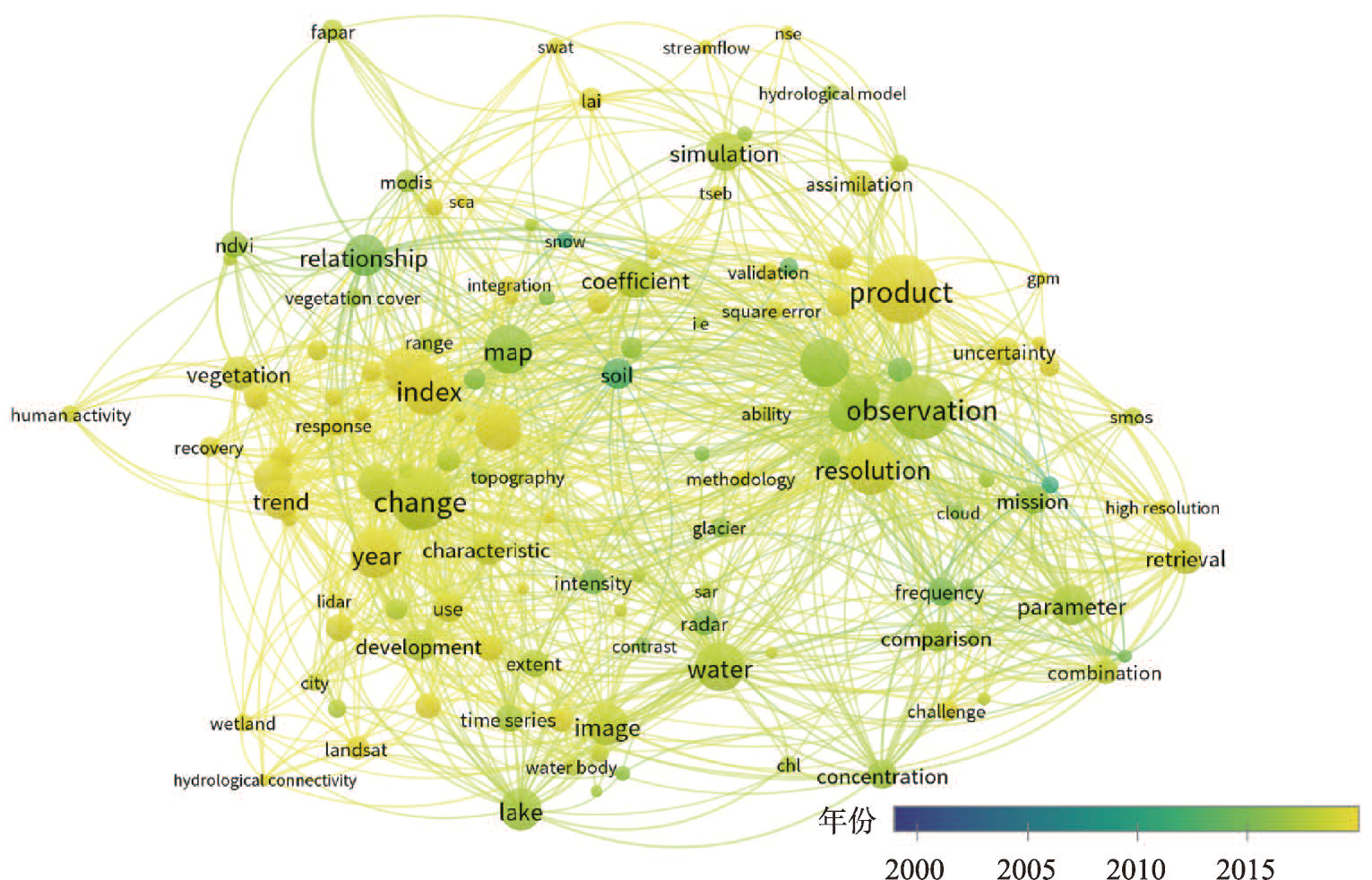
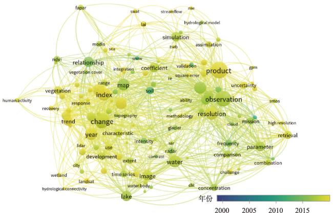
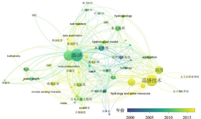
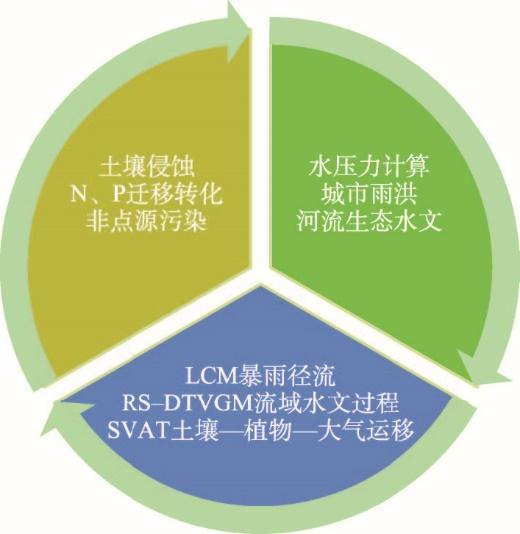
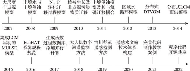
遥感水文模型是水文学与遥感学的交叉领域,既包括水循环要素遥感反演模型,也包括以水文过程模拟分析为对象的遥感水文模型。本文汇总分析20世纪70年代以来遥感在水文方面应用成果,综述遥感水文模型研究历史、现状及发展趋势。研究表明,20世纪70年代以来遥感水文模型就一直是遥感水文的热点;中国在遥感水文研究兴起之时就与国际上同步,在遥感水文的概念认知、遥感与水文相结合的科学认识,以及遥感水文模型的研发应用等诸多方面做出了探索性的成果。随着信息技术发展,结合多重信息采集手段,围绕遥感径流监测、多传感器智能物联网、缺资料区水文分析和流域水量—水质—水生态精细化模拟等重大实际问题是遥感水文模型发展的趋势。
杨胜天 , 鱼京善 , 娄和震 , 孙文超 , 赵长森 , 王雪蕾 , 宋文龙 , 蔡明勇 , 代韵萌 . 遥感水文模型研究综述[J]. 地理学报, 2023 , 78(7) : 1691 -1702 . DOI: 10.11821/dlxb202307010
Remote sensing in hydrology is a crossing field of hydrology and remote sensing. It not only includes remote sensing retrieval models for water cycle factors, but also covers remote sensing hydrological models which serve for calculating the process of hydrology. This review focuses on the past, present and future development of remote sensing hydrological model by using the meta-analysis method and collecting related research in the past 40 years. The results show that remote sensing hydrological model has played a key role in remote sensing hydrology since the 1970s in the world. In China, the researchers of remote sensing in hydrology keep pace with global scientists, and prominent achievements include the concept generation about the remote sensing hydrology, promotion of the combination between remote sensing and hydrology and development of remote sensing hydrological models. In the future, by the help of enhanced information technology, the remote sensing hydrological models will pay more attention to the runoff monitoring by using remote sensing, the intelligent web of hydrological sensors, hydrological analysis in the data scarce watersheds, and the precise simulation of the water flow, water quality as well as the water ecology.
| [1] |
[ 刘昌明, 陈志恺. 中国水资源现状评价和供需发展趋势分析. 北京: 中国水利水电出版社, 2001.]
|
| [2] |
|
| [3] |
|
| [4] |
|
| [5] |
|
| [6] |
|
| [7] |
|
| [8] |
|
| [9] |
|
| [10] |
|
| [11] |
[ 胡四一. 德意志联邦共和国遥感技术在水文和水资源中的应用介绍. 江苏水利, 1984(3): 123-128.]
|
| [12] |
[ 王燕生. 遥感水文模型及其应用. 水文, 1989, 9(5): 20-24.]
|
| [13] |
[ 杨积成. 新一代水文遥感潜力展望. 环境遥感, 1991(3): 187-190.]
|
| [14] |
[ 傅国斌, 李丽娟, 刘昌明. 遥感水文应用中的尺度问题. 地球科学进展, 2001, 16(6): 755-760.]
|
| [15] |
[ 陈至立. 辞海. 上海: 上海辞书出版社, 2022.]
|
| [16] |
[ 李纪人. 与时俱进的水利遥感. 水利学报, 2016, 47(3): 436-442.]
|
| [17] |
[ 张仁杰. 从遥感信息到水文模型参数. 遥感信息, 1987, 2(1): 13-16, 28.]
|
| [18] |
[ 熊江波. 用遥感资料确定水文模型参数的方法. 环境遥感, 1987(1): 33-43, 83.]
|
| [19] |
[ 王芳, 王浩, 陈敏建, 等. 中国西北地区生态需水研究(2): 基于遥感和地理信息系统技术的区域生态需水计算及分析. 自然资源学报, 2002, 17(2): 129-137.]
|
| [20] |
[ 薛安, 倪晋仁, 马蔼乃. 模型与GIS集成理论初步研究. 应用基础与工程科学学报, 2002, 10(2): 134-142.]
|
| [21] |
[ 刘家宏, 王光谦, 李铁键. 数字流域模型关键技术研究. 人民黄河, 2005, 27(6): 1-3, 63.]
|
| [22] |
[ 夏军, 左其亭. 国际水文科学研究的新进展. 地球科学进展, 2006, 21(3): 256-261.]
|
| [23] |
[ 赵少华, 邱国玉, 杨永辉, 等. 遥感水文耦合模型的研究进展. 生态环境, 2006, 15(6): 1391-1396.]
|
| [24] |
[ 李新, 刘强, 柳钦火, 等. 黑河综合遥感联合试验研究进展: 水文与生态参量遥感反演与估算. 遥感技术与应用, 2012, 27(5): 650-662.]
|
| [25] |
[ 杨大文, 徐宗学, 李哲, 等. 水文学研究进展与展望. 地理科学进展, 2018, 37(1): 36-45.]
|
| [26] |
[ 刘元波, 吴桂平, 赵晓松, 等. 流域水文遥感的科学问题与挑战. 地球科学进展, 2020, 35(5): 488-496.]
|
| [27] |
[ 岩腊, 龙笛, 白亮亮, 等. 基于多源信息的水资源立体监测研究综述. 遥感学报, 2020, 24(7): 787-803.]
|
| [28] |
[ 李崇巍, 王志慧, 汤秋鸿, 等. 1986—2019年黄河流域地表水体动态变化及其影响因素. 地理学报, 2022, 77(5): 1153-1168.]
|
| [29] |
|
| [30] |
|
| [31] |
[ 刘昌明, 刘璇, 杨亚锋, 等. 水文地理研究发展若干问题商榷. 地理学报, 2022, 77(1): 3-15.]
|
| [32] |
|
| [33] |
[ 许有鹏, 陈钦峦, 朱静玉. 遥感信息在水文动态模拟中的应用. 水科学进展, 1995, 6(2): 156-161.]
|
| [34] |
[ 沈晓东, 王腊春, 谢顺平. 基于栅格数据的流域降雨径流模型. 地理学报, 1995, 50(3): 264-271.]
|
| [35] |
[ 刘昌明, 杨胜天, 温志群, 等. 分布式生态水文模型EcoHAT系统开发及应用. 中国科学: 技术科学, 2009, 39(6): 1112-1121.]
|
| [36] |
|
| [37] |
|
| [38] |
|
| [39] |
[ 徐宗学. 水文模型: 回顾与展望. 北京师范大学学报(自然科学版), 2010, 46(3): 278-289.]
|
| [40] |
[ 王鹏飞, 杨胜天, 王娟, 等. 星—机一体的水力几何形态流量估算方法. 水利学报, 2020, 51(4): 492-504.]
|
| [41] |
|
| [42] |
[ 宋文龙, 吕娟, 刘昌军, 等. 遥感技术在数字孪生流域建设中的应用. 中国防汛抗旱, 2022, 32(6): 15-20.]
|
| [43] |
[ 高吉喜, 蔡明勇, 张新胜, 等. 大尺度生态干扰风险评估技术方法及应用研究. 中国环境科学, 2021, 41(11): 5274-5281.]
|
| [44] |
[ 王雪蕾, 王新新, 朱利, 等. 巢湖流域氮磷面源污染与水华空间分布遥感解析. 中国环境科学, 2015, 35(5): 1511-1519.]
|
| [45] |
[ 吕爱锋, 贾绍凤. 遥感驱动的分布式实际径流模拟研究. 南水北调与水利科技, 2016, 14(3): 7-11.]
|
| [46] |
|
| [47] |
|
| [48] |
|
| [49] |
|
| [50] |
|
/
| 〈 |
|
〉 |