青藏高原地形起伏度及其地理意义
封志明1,2,3( ), 李文君1,2, 李鹏1,2,3(), 肖池伟1,2
), 李文君1,2, 李鹏1,2,3(), 肖池伟1,2
Relief degree of land surface and its geographical meanings in the Qinghai-Tibet Plateau, China
FENG Zhiming1,2,3(), LI Wenjun1,2, LI Peng1,2,3(), XIAO Chiwei1,2
), LI Wenjun1,2, LI Peng1,2,3(), XIAO Chiwei1,2
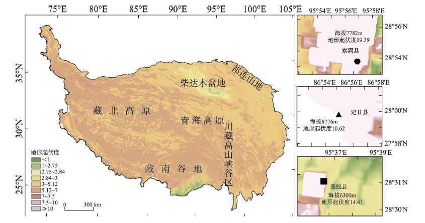
图5. 基于最佳分析窗口的青藏高原不同等级地形起伏度空间分布
Fig. 5. Spatial distribution of the relief degree of land surface (RDLS) derived from the optimal analysis window method in the Qinghai-Tibet Plateau, China