秦岭—大巴山高分辨率气温和降水格点数据集的建立及其对区域气候的指示
A high-resolution grid dataset of air temperature and precipitation for Qinling-Daba Mountains in central China and its implications for regional climate
秦岭—大巴山高分辨率气温和降水格点数据集的建立及其对区域气候的指示 |
| 陆福志,鹿化煜 |
|
A high-resolution grid dataset of air temperature and precipitation for Qinling-Daba Mountains in central China and its implications for regional climate |
| LU Fuzhi,LU Huayu |
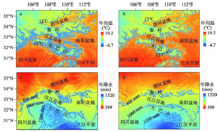
| 图4 秦岭—大巴山年均温(a, b)和年降水(c, d)空间分布(a、c来自QB-2018数据集(本文),b、d来自WorldClim 2.0数据集[ |
| Fig. 4 Spatial distribution of annual mean temperature (a, b) and annual precipitation (c, d) in the Qinling-Daba Mountains, where (a) and (c) are from QB-2018 dataset (this study) while (b) and (d) are from WorldClim 2.0 dataset[ |
|
|