1947年中国南海断续线精准划定的地形依据
Spatial demarcation principles of the Dotted Line in the South China Sea
1947年中国南海断续线精准划定的地形依据 |
| 唐盟, 马劲松, 王颖, 夏非 |
|
Spatial demarcation principles of the Dotted Line in the South China Sea |
| Meng TANG, Jinsong MA, Ying WANG, Fei XIA |
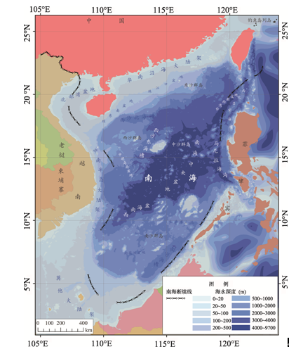
| 图2 中国南海海底数字地形图注:图中“南海断续线”取自1947年中国政府内政部制1:400万《南海诸岛位置图》。 |
| Fig. 2 Digital topographic map of the South China Sea |
|
|