克里雅河下游沉积物的光释光年龄与晚更新世末以来沙漠的形成
OSL chronology reveals Late Pleistocene floods and the impact on landform evolution at the lower reaches of the Keriya River in the Taklamakan Desert
注:① 牙通古斯和安迪尔河下游剖面[
克里雅河下游沉积物的光释光年龄与晚更新世末以来沙漠的形成 |
| 张峰, 王姣, 马丽, 迪丽拜尔·吐尔孙 |
|
OSL chronology reveals Late Pleistocene floods and the impact on landform evolution at the lower reaches of the Keriya River in the Taklamakan Desert |
| ZHANG Feng, WANG Jiao, MA Li, TURSUN·Dilibaier |
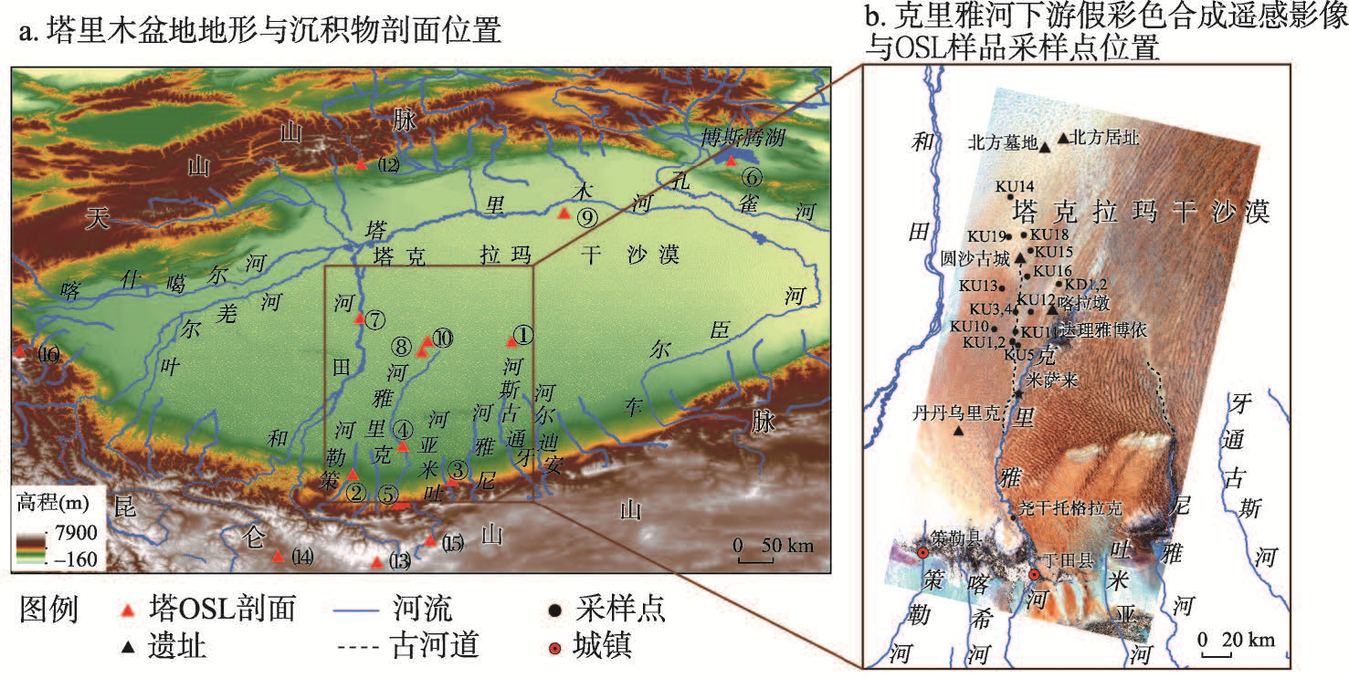
| 图1 塔里木盆地地形与沉积物剖面位置及克里雅河下游Landsat8 OLI假彩色合成遥感影像(RGB: 7-5-2)与OSL样品采样点位置 注:① 牙通古斯和安迪尔河下游剖面[ |
| Fig. 1 Map showing the elevation of the Tarim Basin (ASTER GDEM). Red solid triangles represent the location of published age sampling sites and processed Landsat8 (Operational Land Imager, OLI) false color image (RGB: 7-5-2) showing the Keriya River lower reaches and sampling sites in this work |
|
|