面向高分卫星遥感共性产品真实性检验的无人机空港布局
Unmanned aerial vehicle airports for verification of common products from China High-resolution Earth Observation System (CHEOS)
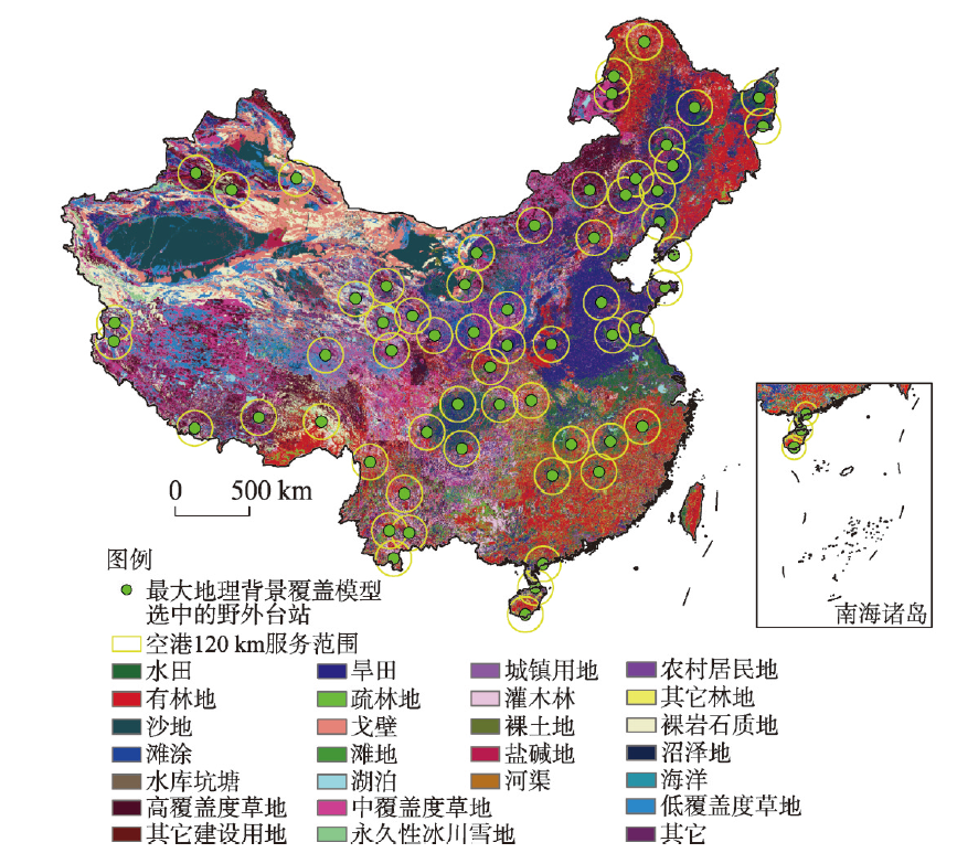
注:基于自然资源部标准地图服务网站GS(2021)5447号地图绘制,底图边界无修改。
面向高分卫星遥感共性产品真实性检验的无人机空港布局 |
| 刘俊伟, 陈鹏飞, 鹿明, 廖小罕 |
|
Unmanned aerial vehicle airports for verification of common products from China High-resolution Earth Observation System (CHEOS) |
| LIU Junwei, CHEN Pengfei, LU Ming, LIAO Xiaohan |
| 图4 基于最大地理背景覆盖模型确定的无人机空港位置及服务覆盖区域 注:基于自然资源部标准地图服务网站GS(2021)5447号地图绘制,底图边界无修改。 |
| Fig. 4 Spatial distribution of unmanned aerial vehicle airports selected by geographical background covering model and its service coverage |
|
|