基于多源遥感影像的洞庭湖地形提取方法
隆院男1,2,闫世雄1,蒋昌波1,2( ),吴长山2,3,李志威1,2,唐蓉1
),吴长山2,3,李志威1,2,唐蓉1
A new method for extracting lake bathymetry using multi-temporal and multi-source remote sensing imagery: A case study of Dongting Lake
LONG Yuannan1,2,YAN Shixiong1,JIANG Changbo1,2(),WU Changshan2,3,LI Zhiwei1,2,TANG Rong1
),WU Changshan2,3,LI Zhiwei1,2,TANG Rong1
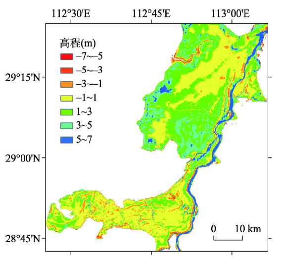
图8. 克里金法与实测地形差值图
Fig. 8. Comparison of the results of Kriging model withmeasured data grided model (m)