基于多源遥感影像的洞庭湖地形提取方法
隆院男1,2,闫世雄1,蒋昌波1,2( ),吴长山2,3,李志威1,2,唐蓉1
),吴长山2,3,李志威1,2,唐蓉1
A new method for extracting lake bathymetry using multi-temporal and multi-source remote sensing imagery: A case study of Dongting Lake
LONG Yuannan1,2,YAN Shixiong1,JIANG Changbo1,2(),WU Changshan2,3,LI Zhiwei1,2,TANG Rong1
),WU Changshan2,3,LI Zhiwei1,2,TANG Rong1
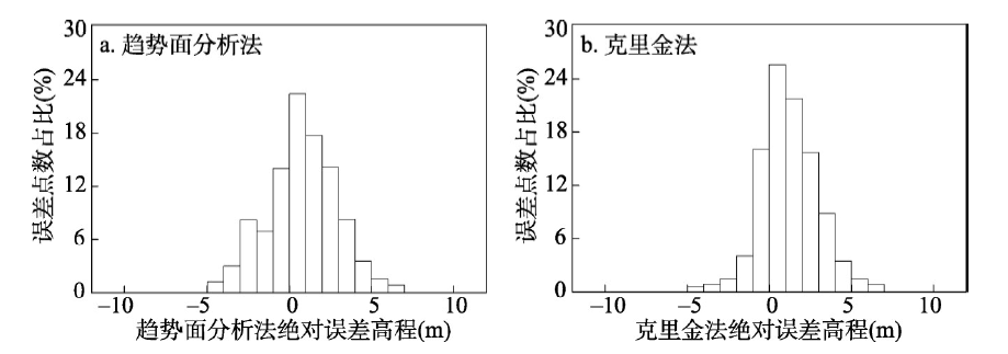
图7. 绝对误差柱状图
Fig. 7. Histogram of absolute error